Gillman is not empty land. It is a mature forest decades in the making that cannot be recreated, a living link between Berlayer Creek, Labrador and the Southern Ridges, and one of Singapore’s most effective natural cooling landscapes. It is a sanctuary where people walk, breathe and restore their health, and one of the rare places where heritage, art and nature meet. Clear it, and none of it comes back.
Drag the handle to compare. Gillman today, against the indicative extent of forest that would be cleared under the plan published on 10 July 2026, drawn by residents from the Environmental Impact Assessment. It maps forest area, not individual buildings. On 14 August the Government said more will be kept, without saying how much. Three weeks on, no revised plan has been published.
Make your voice heard
Each one opens with a short primer, then the letter or the form. Also worth doing while the plan is being redrawn: .
Decades of natural regeneration that cannot simply be recreated.
Wildlife habitat and ecological connectivity
A vital link between Berlayer Creek, Labrador Nature Reserve and the Southern Ridges.
Natural cooling and cleaner air
One of Singapore’s most effective natural urban cooling landscapes.
A sanctuary for people
Daily access to walking, forest bathing, birdlife and restorative green space.
Health and wellbeing
Proven benefits for physical health, mental wellbeing and quality of life.
Gillman Barracks’ unique identity
A rare place where heritage, arts and nature exist together.
An irreplaceable legacy
Once cleared, these ecological and community values cannot be fully restored.
Who else lives here
Gillman is somebody’s habitat. These are its residents and the layers of forest they depend on, all photographed here by people who walk this ground.
In the canopy
Oriental pied hornbill
Anthracoceros albirostris
Nests inside natural cavities in old, large trees. Those hollows take decades to form, so a replanted forest cannot offer them.
In the dense growth
Straw-headed bulbul
Pycnonotus zeylanicus
Critically endangered worldwide, and Singapore holds close to a third of every one left. It lives almost only where dense low growth overhangs running water, which is what the stream through this forest still provides. The bird here is a juvenile.
Photograph by AL Karim
At the flowers
Crimson sunbird
Aethopyga siparaja
Singapore’s national bird, here feeding at a heliconia. It pollinates as it moves between flowering plants along the forest edge.
At the forest edge
Brown-throated sunbird
Anthreptes malacensis
Works the flowering trees along the boundary of the forest, taking nectar and the small insects that come with it. The edge is the strip a clearance line cuts through first.
Photograph by AL Karim
In the fruiting trees
Black-naped oriole
Oriolus chinensis
Follows the fruiting season through the canopy, carrying seeds well beyond the tree it fed in. An Asian glossy starling feeds on the same palm below it.
At the treetops
Common hill myna
Gracula religiosa
Nests at the bottom of deep cavities ten metres or more up a tall tree, and cannot cut one itself. It takes over holes left by woodpeckers, so it needs old timber and the birds that work it. Neither of those arrives with a replanting.
Photograph by AL Karim
In the mid storey
Greater racket-tailed drongo
Dicrurus paradiseus
A forest specialist and a skilled mimic. It hunts insects flushed by other birds, so it needs a forest with a full community living in it.
On the trunks
Common flameback
Dinopium javanense
Chisels nest holes into old and dying trees. Other species move into those holes afterwards, so a forest cleared of ageing timber loses them too.
In the understorey
White-crested laughingthrush
Garrulax leucolophus
Moves in loud family parties through the dense low growth, which is the first layer to go when land is cleared.
After dark
Common palm civet
Paradoxurus hermaphroditus
Native, nocturnal and seldom seen. It spreads the seeds of the fruit it eats, quietly replanting the forest as it goes.
The old trees
A strangler fig, decades in the making
Aerial roots that have fused into trunks and braided down to the floor, on ground the forest quietly took back. This is what regeneration looks like when it is left alone, and it is the one thing no replanting scheme can deliver on any timescale that matters.
Video by M Saniroz AR
The freshwater stream
Running water
A stream threads through the forest floor. It supports its own community of life and feeds into the wider Berlayer Creek system.
The understorey
Dense low growth
Ferns, saplings and climbers below the canopy. This is where most of the forest’s smaller residents feed, shelter and nest.
The canopy
Layers built over decades
Mature trees closing overhead. The layered structure is what cools the air, holds the soil and houses everything above.
Gillman sits between Berlayer Creek, Labrador Nature Reserve and the Southern Ridges. Species like these move between those green spaces. Remove the link in the middle and the habitat on either side is left fragmented.
Gillman stands with Maju
Across the island at Sunset Way, residents are running the same campaign for Maju Forest, a mature secondary forest where 15 of 23 hectares are proposed for clearing to make way for housing. The two plans were announced in the same Master Plan, questioned in the same parliamentary sitting, and carry the same gaps in how the loss was weighed. What is decided at Gillman and Maju will shape how Singapore treats every wild space it has left.
Everything that has passed between residents, our MPs and the agencies, in order, with the current position at the top. This is the page kept up to date.
As of 4 September 2026
The plan is being redrawn, and nobody has published a number
Still no figure
On 14 August the Government said more greenery will be kept at Gillman and fewer homes built than the
July plan showed. Three weeks on there is no revised percentage, no revised hectarage and no revised
corridor width. The only published position remains the July one: 40 per cent of the green spaces retained,
at least 10 hectares of forest cleared, ecological corridors of at least 30 metres.
Residents have put an alternative on the table
On 1 September, at HortPark, residents gave HDB, URA and NParks a worked plan:
. It builds
up to 2,400 homes on more land than the July plan uses, and keeps the forest.
Three things the agencies agreed to look at
NParks is prepared to study the sensory boardwalk and the forest trails. HDB undertook to strengthen
east to west connectivity through the site, and to minimise forest loss if forest has to be removed so that
a sizeable forest remains. It also said that keeping the whole forest is not feasible, and that planning
teams are looking at how to retain more greenery and forest than the July proposal showed.
The questions that went home unanswered
HDB could not give the eventual housing demand or yield for Gillman. Asked what residents would have to
give up in order to keep the forest whole, the answer was that if we do not build here, you have to build
somewhere else. Residents then asked where that would be, who would be affected, and why particular
communities were selected to bear it. That went unanswered, as did why the brownfield alternatives were set
aside, and how the forest itself is valued against other land once HDB had said that land value is more
location based. The agencies will rework the conceptual plan and share a summary findings report in
approximately a month, which would fall in early October. No firm deadline was given, and no timetable for
the next stage of resident engagement.
Which is why a letter still counts
HDB’s written channel stays open, so a letter sent now arrives while the line is being drawn. Under
“Category of Feedback” choose Land Use Plans.
Twelve of the questions and topics residents put to HDB, URA, MND and NParks at HortPark. Open any one to see what happened to it.
NParks responded positively to the stream boardwalk and the forest and nature trails, and said it was prepared to study them. It attached a technical caveat: the exact location and design would have to account for the impact on the trees and on soil conditions. We accept that caveat. We asked for the study, not for a guarantee.
HDB said it would work on strengthening east to west connectivity through the site, and listed better connectivity among the ideas in the Better Plan it considered workable. No width was discussed in the room. The published baseline to widen from is the 30 metre minimum ecological corridor announced on 10 July 2026.
HDB said several times that keeping the whole of the forest is “really not feasible”. It also said planning teams are actively looking at how to increase the greenery and forest retained against the earlier proposal, and undertook that if forest has to be removed it will look at minimising the loss, so that a sizeable forest area remains. HDB asked residents, if some forest had to be cleared, which part they would be prepared to give up.
Residents proposed bringing STB and other relevant agencies into the later discussions, on the argument that Gillman could become a nature, heritage, wellness and tourism destination connecting Kent Ridge, Bukit Chandu, HortPark, Telok Blangah Hill, Mount Faber, Brani and Sentosa. HDB called revitalising Gillman Barracks with the appropriate agencies a good suggestion. No agency was named and no commitment to approach STB was given.
The answer was no. NParks said EIAs are not generally undertaken at the island wide master planning stage. Planning begins at a broad scale and becomes progressively more detailed, with NParks taking part as a technical agency, supplying biodiversity information and assessments alongside other agencies, and URA balancing the competing needs at the end. HDB added that EIAs are relatively new to the planning process, that the approach had broadly been to conduct an EIA, publish it, receive responses and proceed, and that Gillman and Sunset Way had been handled differently.
Asked what it provides at the planning stage, NParks described its role as supplying biodiversity information and assessments as a technical agency. No assessment of urban heat or of climate impact was described at any stage. Residents pressed the point against the 300 cooling centres now being established to shield people from higher temperatures, saying that clearing the forest that cools while announcing the cooling centres makes the government appear, in their word, foolish. If we have misunderstood the scope of that input, we would like to be corrected, because it matters a great deal.
URA said density decisions are site specific, turning on proximity to transport nodes and on height constraints. Areas well served by transport may support greater density, while constraints such as flight paths limit development elsewhere. Residents said they still could not see the criteria being applied, described the process as a “black box”, and asked why lower density might be planned elsewhere while an ecologically significant site near Gillman is considered for development.
HDB was unable to give the eventual housing demand or yield for Gillman at the meeting, and suggested the figure might be clearer once the feedback has been processed. Residents have proposed 10 to 12 blocks near Labrador MRT, roughly 2,400 units, and have said openly that they are not planners and want the domain experts to develop the figure properly. Without a published yield there is no way for anyone outside government to compare the two plans.
This was the question residents pressed hardest. HDB answered in substance that if we do not build here, you have to build somewhere else. Residents then asked precisely where that would be, who would be affected, and why particular communities or sites were selected to bear the impact. Those questions were not answered. One resident gave the reason for asking for the whole forest plainly: “Why do we want 100%? Because you guys keep giving us blank answers.”
A resident asked how much of the decision is a financial one, and how one square metre of carpark land is valued against one square metre of forested land. HDB said it did not take the matter into consideration in the way the question was framed, and that land value is more location based. Residents then asked how the forest itself factors into the decision, and whether its biodiversity, ecological connectivity, recreation, wellbeing and cooling benefits are adequately recognised. That was not answered.
Residents put a list: higher density on built up land in Telok Blangah where technically feasible, building first on urbanised and industrial land including Depot Road and Telok Blangah Street 31, bringing forward housing already planned elsewhere and pushing Gillman further into the future, building part of the housing near Labrador MRT while adjusting the timing of other projects to hold the pipeline steady, revisiting the demographic and housing demand assumptions, and demand side policy such as incentives to help older residents in larger flats downsize. On the Alexandra Park site the residents had identified, HDB said the area is already planned for future housing, which affects a significant part of the Better Plan alternative. HDB also said government planning takes a broad island wide view, and that potential development sites are already considered within it. No reasoning was given in the room for setting the other alternatives aside.
HDB said the feedback from this and other engagements has to be processed and the concept reworked, with a summary findings report expected in approximately a month, which would fall in early October. It suggested the housing yield might be clearer by then. No firm deadline was given, and no timetable for the next stage of resident engagement. Residents had asked for a further meeting at which the agencies could give the projected yield and respond to the Better Plan: “We are not experts… We are calling on you, domain experts, to help us develop this plan to be something buildable.” HDB said it would take the proposals back and consider what form further engagement could take. It was not established whether the findings report ends the process or whether residents will see a revised plan in time to respond to it.
This meeting was not the official engagement. HDB ran that from 6.30 to 8.30pm at HortPark, under the title “Building a Shared Future at Sunset Way & Gillman Barracks”. The meeting recorded here is the one residents asked for and did not get for a fortnight: residents wrote to HDB, URA and NParks on 18 August calling for a working dialogue, the agencies did not respond directly, and after repeated follow ups MND agreed to meet afterwards. It ran in the Fruit Room from 8.49 to 10.21pm, with MP Rachel Ong, around 20 representatives from HDB, URA, MND and NParks, and 25 to 30 residents from Telok Blangah, Depot Road, Preston Road and Pasir Panjang East.
Residents brought a worked alternative to the table: A Better Plan for Gillman, prepared by residents representative of the local community, setting out up to 2,400 homes on 538,000 m² of buildable land across two sites, against 340,000 m² in the July plan, with the forest kept.
What follows is the residents’ record of what was asked and what was answered. It is written at agency level and names no individual officer. Corrections are welcome from anyone who was in the room, including the agencies, and will be published here.
Twelve of the questions and topics residents put to the agencies, and what happened to each of them, are set out at the top of this page. Residents made roughly 69 separate interventions over the course of the evening. The most recurrent were the call to retain the whole forest, the request for the basis on which the planning decision is being made, and the argument that the planning approach itself should change. Residents did not generally frame their position as opposition to housing. They asked the agencies to test whether Singapore’s housing objectives can be met without clearing Gillman Forest, and to explain the evidence and the constraints if the answer is that they cannot.
MP Rachel Ong closed the meeting by expressing the hope that the agencies had heard the appeal, to preserve the forest while still being able to build homes, and that the next stage would involve residents engaging with the plans rather than learning about them through the media.
SG Climate Rally called a gathering at Hong Lim Park in response to the redevelopment
plans, covering Gillman Barracks and Maju Forest alongside other sites. On Sunday afternoon
the lawn filled. People came to speak about access to nature, the loss of forests and natural
spaces, and to ask that decisions on land use are made with transparency and genuine public
involvement, with residents from the Gillman and Maju campaigns running booths at the edge of
the crowd.
The lawn at Hong Lim Park on Sunday afternoon, 16 August. Photographs shared by participants.
Between the booths and the stage.Build homes. Keep the forest. The Gillman banners on the lawn.Green dots on the residents’ board, marking what people want weighed in the decisions ahead.Printing shirts at the campaign booths.
Minister of State for National Development Alvin Tan said at a doorstop that the plans for both Gillman Barracks and Maju Forest will be adjusted to retain more greenery than the July plans showed, at the cost of fewer homes. He said the plans were never final, that the Government would “work out exactly how much more”, and that they would be finalised over the coming month or so.
No figure has been published since. The July plan remains the only published position: 40 per cent of the green spaces retained, at least 10 hectares of forest cleared, and ecological corridors of at least 30 metres. The 30 metre figure is not a new concession, as it was in HDB’s original announcement of 10 July.
Residents walked from Telok Blangah Hill Park along the Forest Walk and into Gillman Barracks,
following the connections between nature, heritage and community that so many people spoke about at
the 30 July dialogue. The route, the flyer and the meeting point are kept here as a record, and for
anyone who wants to walk it on their own.
Date
Saturday, 8 August 2026
Time
8.00am
Meeting point
Telok Blangah Hill Park, at the Forest Walk entrance
Ends at
Kyuukei Coffee, Gillman Barracks
Duration
About 1.5 to 2 hours
The route goes at a leisurely pace, with pauses along the way to take in the
ecology, the heritage buildings and the community spaces. It is worth walking at any time. Every person
who walks it is one more person who has stood in this forest.
Scan this with your phone and Google Maps will route you from wherever you are to the exact spot we are meeting.
The flyerMeeting point, the Forest Walk entrance at Telok Blangah Hill ParkThe route through the Southern Ridges
Tap any image to enlarge.
More than 20 questions on Gillman Barracks and Maju Forest were filed for this sitting by members from both sides of the House. Answering for the Ministry of National Development, Minister of State Alvin Tan said the plans for both sites are not final, that engagement with stakeholders will continue after the consultation closes on 6 August, and that agencies will publish a report summarising their responses to the feedback and any changes made to the plans.
On Gillman specifically, he said the Government is studying how to retain most of the native dominated secondary forest, how to maintain ecological connections east to west between Telok Blangah Hill Park and HortPark and north to south towards Berlayer Creek and Labrador Nature Reserve, and how to retain all buildings of exceptional heritage significance and most of those rated high. He said the number of homes has not been fixed, that the current conceptual plan already carries fewer homes in order to keep green and heritage areas, and that conserving more would mean building fewer still.
The questions residents had asked were these:
Which parts of the plan remain open to change, and whether site clearance or tenders will wait for the feedback to be considered.
Whether alternative sites were evaluated, and whether a smaller footprint or lower density at Gillman itself was assessed against the current plan.
Whether dialogue sessions with residents, heritage groups and nature groups will follow once feedback closes on 6 August.
What threshold of harm would set a site aside, given that both assessments rate the biodiversity impact as major negative even after mitigation.
Whether under-used state land, including the grounds of black and white bungalows and ageing low-rise estates, was assessed first.
What urban heat modelling was done, and what the effect on surrounding homes is expected to be.
Whether the phased clearance plan includes checkpoints where monitoring data is reviewed before further clearance is authorised.
Episode 158 of the programme was given over to a discussion of Maju Forest and Gillman Barracks, with Melissa Low, Head of the NUS Sustainability Academy, and Muhd Nasry, Executive Director of Singapore Youth Voices for Biodiversity. Melissa Low helped organise the residents’ dialogues at Telok Blangah.
A session at EtonHouse, Orchard Road, hosted by the Young PAP Advisers and moderated by a member of the Nature Society, held under Chatham House rules. It opened with an explanation of how an Environmental Impact Assessment is commissioned and what it covers, then moved to open questions and four smaller discussion groups.
Recurring themes from the floor:
The four-week feedback window is too short for a report of this size, and is the same regardless of how large the development is.
An EIA is commissioned only after the decision to redevelop has been made, so it can mitigate but not reconsider. The Nature Society noted there is no precedent for such a decision being reversed, and that the time to be heard is during Master Plan brainstorming — while adding that feedback through the HDB channel is still worth giving.
The assessment covers flora and fauna but not urban heat, cultural value, opportunity cost, or the interests of future generations.
Doubts about whether mitigation measures are enforced, citing Berlayer Creek at the former Keppel site, where trees and mangroves were lost despite similar assurances.
Questions about the transparency of the housing demand figures behind the plans.
Calls for the Ministry of Sustainability and the Environment to take a leading role.
On Gillman specifically: most of the native-dominated forest would be kept, but a large area of exotic forest would be lost, and the corridor to Labrador Park at 30 m is narrower than it should be. Gillman is the connector between the Southern Ridges and Labrador Park; without it, the forests fragment.
MP David Hoe asked each group for the one question they would most want put to Parliament, and said that public feedback can make a difference — “nothing is cast in stone”.
Residents came together for a community-led dialogue, “The Future of Gillman Barracks”, to understand the plans and share their views ahead of the sessions with the planning agencies.
The documents
Looking for who to write to? The names, the addresses and what to put in a letter now live on one page.
Report
This record is maintained by residents of Telok Blangah. It is not affiliated with the Housing & Development Board, the Urban Redevelopment Authority, the National Parks Board, or any political party. Documents are published as sent, with the writers’ permission; personal contact details have been removed.
Events
Walks, talks and gatherings where you can see Gillman Forest for yourself, or meet the residents working to keep it.
A morning walk led by resident Amanda Ruiqing Flynn. Start at Gillman Barracks with the birdsong, then walk into the forest and past the ruins, and loop back to the start.
Time
8am to 11am
Meet
Gillman Barracks. The exact meeting point is sent after you register.
Chinese orchestral music on the theme of nature. Local nature groups hold activities in the lobby before the concert. Visit the Save Gillman Forest booth there.
Time
Lobby activities from 4.15pm. Concert at 5pm.
Where
SOTA Concert Hall, School of the Arts, 1 Zubir Said Drive
Programme
Legend of the White Snake, Courtyard After the Rain, Formosa: A Journey of Taiwan, and more
Tickets
Cat 1 S$26, Cat 2 S$20 on BookMyShow. Save S$2 a ticket on 2 or more, or S$4 a ticket on 4 or more.
HDB held a dialogue with residents on the plans for Gillman Barracks and Sunset Way at HortPark.
Residents brought something of their own to it: ,
showing where the homes can go without clearing the forest. NParks said it is prepared to study the
boardwalk and the forest trails, the agencies undertook to look at widening connectivity and minimising forest
loss, and four questions went unanswered.
SG Climate Rally called a gathering at Hong Lim Park in response to the redevelopment
plans, covering Gillman Barracks and Maju Forest alongside other sites. On Sunday afternoon
the lawn filled. People came to speak about access to nature, the loss of forests and natural
spaces, and to ask that decisions on land use are made with transparency and genuine public
involvement, with residents from the Gillman and Maju campaigns running booths at the edge of
the crowd.
The lawn at Hong Lim Park on Sunday afternoon, 16 August. Photographs shared by participants.
Between the booths and the stage.Build homes. Keep the forest. The Gillman banners on the lawn.Green dots on the residents’ board, marking what people want weighed in the decisions ahead.Printing shirts at the campaign booths.
Residents walked from Telok Blangah Hill Park along the Forest Walk and into Gillman Barracks,
following the connections between nature, heritage and community that so many people spoke about at
the 30 July dialogue. The route, the flyer and the meeting point are kept here as a record, and for
anyone who wants to walk it on their own.
Date
Saturday, 8 August 2026
Time
8.00am
Meeting point
Telok Blangah Hill Park, at the Forest Walk entrance
Ends at
Kyuukei Coffee, Gillman Barracks
Duration
About 1.5 to 2 hours
The route goes at a leisurely pace, with pauses along the way to take in the
ecology, the heritage buildings and the community spaces. It is worth walking at any time. Every person
who walks it is one more person who has stood in this forest.
Scan this with your phone and Google Maps will route you from wherever you are to the exact spot we are meeting.
The flyerMeeting point, the Forest Walk entrance at Telok Blangah Hill ParkThe route through the Southern Ridges
Tap any image to enlarge.
In the news
What the press has written about Gillman Barracks since HDB released its studies on
10 July 2026, including the coverage that deals with Maju Forest alongside it, and the
petition updates that put the residents’ own case.
Commentary and opinion
These are the views of their authors and of the publications that carried them.
P Tan points readers to the public feedback exercise the Ministry of Sustainability and Environment has opened on Singapore’s long term climate adaptation plan, whose stated focus areas are extreme weather, water and food security, liveability and public health. His argument is that these are the same risks residents have been raising over Gillman and Maju, but that the draft plan lists biodiversity and greenery without saying that keeping existing secondary forest counts as adaptation, and without setting any threshold for how much forest can be lost before resilience is affected. He cites an academic estimate that as much as 7,331 hectares of secondary forest could be converted over the coming decade, roughly a tenth of the island, notes again that MSE holds no land use mandate, and suggests Singapore adopt the natural asset valuation methods already used in more than 30 countries. Submissions need a Singpass login and no closing date has been given.
An editorial that lays the Government’s statements end to end, from the 4 August sitting to the engagement sessions of 1 and 2 September, and finds that one quantity has never been produced: how many homes Gillman Barracks and Maju Forest are meant to deliver, and against what measured demand. It notes that the draft Master Plan 2025 carries indicative site yields for Newton, Patterson and Bayshore but none for Gillman or Sunset Way, that the commitment of 14 August to retain more greenery still had no figure attached to it nineteen days later, and that oversubscription at recent launches measures the supply an agency chose to release rather than the housing a site is required to provide. It also records that three MPs from both sides of the House asked whether environmental studies could be done before land is zoned, that none received a direct answer, and that NParks told residents at HortPark on 1 September that no assessment is carried out when the island wide land use plan is drawn.
Morgan Taylor reports on what researchers say the environmental studies leave out, taking Maju Forest as the case. The reviews cover pollution, waste and biodiversity, but not the way a forest regulates temperature, air quality and flood risk in the neighbourhoods around it, which is the effect residents and nature groups keep raising. She cites work from Singapore Management University finding that clearing the site would raise local heat, worsen air quality and increase flooding risk, and a 2024 National University of Singapore study projecting heat related productivity losses of about $2.22 billion a year by 2035. Set against the $100 billion Singapore has committed to climate adaptation, the argument she reports is that a standing forest is itself adaptation infrastructure rather than a development site, and that 2026 being named the Year of Climate Adaptation sits awkwardly with frameworks that give no particular weight to the secondary forest covering roughly 16 per cent of the island.
P Tan points readers to the Business Times commentary of 4 September and sets out the argument he takes to be its central one, that scarce land raises rather than lowers the cost of allocating it badly, and that the alternative to this development is not no development at all. He notes that A Better Plan for Gillman came from about 25 residents of Telok Blangah, Depot Road, Preston Road and Pasir Panjang East who worked evenings and weekends after their MP asked them to propose rather than object, and that it was presented to agencies on 1 September. His test is that if another configuration can supply the homes while keeping more forest and putting the heritage buildings to use, the plan should be open to change.
Melissa Low, head of the NUS Sustainability Academy and a Telok Blangah resident who took part in the Gillman discussions, replies to Leslie Yee’s commentary of 31 August and moves the question from whether Singapore needs homes to how many of them this particular forest is actually required to supply. Her argument is that residents are not asking HDB to stop building: A Better Plan for Gillman, developed by residents from Telok Blangah, Depot Road, Preston Road and Pasir Panjang East and presented to agencies on 1 September, sets out 10 to 12 blocks near Labrador MRT for up to 2,400 units and asks whether the rest could sit in Alexandra Park or on other already urbanised land. She holds that scarcity cuts both ways, because scarce land raises the cost of allocating it badly, and that an existing forest is not interchangeable with a landscaped park given habitat, connectivity, cooling and the site’s place in the landscape between the Southern Ridges and Labrador. Her test is a plain one: if keeping the whole forest is genuinely not feasible, the government should be able to explain why, and if another configuration provides the same homes while retaining more nature and activating the heritage buildings, the plan should change.
Helmi Yusof turns to the part of the site the debate has passed over. Almost everything written since July has been about the forest and the biodiversity, and very little about the 6.4 hectare gallery enclave, which he argues does something that galleries scattered across the island cannot: a visitor walks from one show to the next, and the shows inform each other. Written as a review of the exhibitions running there now, and the strongest statement yet of the cultural value the campaign has been slower to press. Behind the BT paywall.
P Tan reports back on the 1 September session at Hort Park, an invitation only focus group of five tables that left roughly an hour for discussion and ran without topographic maps, and points readers to the Parliament sitting on 8 September as the next moment at which writing to an MP still counts.
Olivia Choong, president of the Singapore Gardening Society, writes on the World Day of Prayer for the Care of Creation and sets Gillman Barracks beside Maju Forest as a question of stewardship rather than of sentiment. Her argument is that the remaining green spaces cannot be judged one at a time, because each loss falls on a network that is already thin, and that a forest does work no planted replacement matches: habitat, carbon storage, stormwater management, cooling and measurable effects on health. She treats the retention announcement of 14 August as a partial result rather than a settled one, on the view that the real test is whether land use is reconsidered, and closes with what readers can do, from writing to their MP and filing feedback with the ministry to supporting the nature groups already at work.
P Tan, who started the petition, writes on the invitation that reached some residents by email on 23 August for “Building A Shared Future at Sunset Way & Gillman Barracks” at Hort Park on 1 September, 6.30pm to 8.30pm, with an RSVP deadline the following day. His concern is the shape of the session rather than the fact of it: two hours shared between two sites with different terrain, different ecology and, at Gillman, a social heritage and a set of community nodes that Sunset Way does not have. He asks those who RSVP to request the agenda and format in advance, on the reasoning that a presentation with a short question and answer would settle very little where a proper breakout might. His reading, offered as his own and not as fact, is that the scope may be confined to refining the Conceptual Housing Plan, and that the openings worth using are the development and conservation boundaries, the ratio of retained forest to planted greenery, urban heat and flood modelling, and the community value the studies have passed over. How invitees were selected has not been explained, and he was not among them.
P Tan takes the ministry spokesman’s timing as the point that matters. It came ten days after the sitting, while the further engagement promised in Parliament had not yet happened and residents were still working with their MP to arrange a meeting, which raises the question of whether the next announcement will be the plan already settled. He notes that questions filed by MP Rachel Ong remain unanswered, that the next sitting has yet to be scheduled, and that the rally at Hong Lim Park drew more than a thousand people, a turnout he reads as high by Singapore standards. Against 23 parliamentary questions and 34 supplementary questions from both sides of the House, his argument is that the case has moved beyond one site to how the country decides what its remaining forests are for, and that the window in which writing to a ministry or an MP still counts is the one now open.
The Usual Place gives an episode to the civic response rather than to the plans themselves, with host Natasha Ann Zachariah, George Wong, assistant professor of sociology at the Singapore Management University, and Jonathan Ng, a policy consultant and former civil servant. Ng argues that consultation feels performative when the public is brought in after the policy has already been cooked, and proposes a two stage process in which the Government narrows the options, sets out the trade offs and the alternatives it considered, and only then goes to a wider public while the outcome can still change. Wong reads the counter proposals, self organised town halls and the rally as a sign that the policymaking room is widening, and says those who enter it should expect to build consensus rather than to prevail. Both close by urging advocates to organise, join groups and take part in person rather than argue on social media.
The Government calls 6.9 million a planning parameter rather than a target, yet it has published no aggregate population, household or housing stock scenario for the pipeline now being assembled, from Gillman and Maju to the Greater Southern Waterfront, Paya Lebar Air Base, the Kallang River corridor and the redevelopment of ageing estates under VERS. The editorial sets out what each component is expected to deliver, notes that three Workers’ Party members asked in three different forms for the projections behind the need to build on these two forests and received general demographic trends in reply, and argues that without the arithmetic the public cannot tell whether Gillman is needed to meet a dated shortfall, held as contingency, or part of a far larger growth scenario that has never been disclosed.
Kirsten Han’s weekly newsletter takes issue with how the retained greenery announcement was framed, as a concession residents must pay for in lost homes, and asks whether a consultation that let people participate from the start would have surfaced options beyond that single trade off.
Heng Li Seng takes this year’s National Day theme at its word. The official framing casts “Go Beyond” as a call to do better for Singapore and to show greater care and concern for one another. His argument is that if citizens are asked to go beyond, the state has to build the means for them to take part in the decisions that shape the country, rather than inviting comment once the decision has already been made.
Yong Feng, who masterplanned the Keppel Club site as an HDB planner and sat through its environmental assessment, describes the process from the inside. He writes that a plot shaded “Residential” on the Master Plan is treated as ready for the taking whatever lies beneath it, that planners are not given the reasoning or the figures behind the housing targets they are working to, and that almost every existing tree went even inside the green corridors he had drawn to keep them. On Gillman he notes that the plans were shown at the Draft Master Plan 2025 exhibition as a single dot on one panel among more than fifty, so that a visitor could reasonably have assumed the housing would replace the barracks buildings rather than the forest beside them. His conclusion is that the impact assessment framework as it stands is a method of containment rather than a real decision point, and that only sustained public pressure has forced the plans to be defended at all.
Melissa Low of NUS reads the Gillman and Maju episode as a test of the planning system rather than of one site, setting out what residents did with the technical reports and what the response left unanswered. She asks whether an Environmental Impact Assessment is meant to shape a decision or only to soften one, notes that a “Major Negative” finding was never said to be capable of stopping a project, and argues for earlier engagement, a Community Impact Assessment alongside the environmental and heritage studies, and a published response matrix showing how each submission was weighed. The clearest account yet of why the process itself became the argument.
A National Day editorial that sets the Gillman consultation beside the acquisition of 38 Oxley Road, arguing that public value was allowed to decide whether one site was developed at all, while at Gillman the severest ecological rating the assessors could give was only ever permitted to change the shape of the development rather than whether it went ahead.
Sets out the ministry’s promise to publish agencies’ responses and any changes to the plans, then asks whether that report will also show what environmental advice went into the decision and how much weight it carried.
Answers the claim that these are merely secondary forests by setting out what the Gillman environmental assessment actually recorded, and notes that no threshold of ecological harm has been published at which a site would be set aside rather than simply mitigated.
Rachel Oh, a conservation researcher at the National University of Singapore, sets out what is lost when a mature secondary forest is replaced by planted greenery. Her argument is that structural complexity takes decades to build, so the two are not interchangeable in the way a retention percentage implies. Written about Maju, it bears directly on how the retained area at Gillman should be judged.
Andie Ang and Sankar Ananthanarayanan, who co-authored the Singapore Terrestrial Conservation Plan, argue that the country has shown what it can do for nature and should now decide what it will not trade away. They note that undeveloped land is treated as a land bank, its ecological value considered only later through an impact assessment, and say they know of no case where a proposed development was cancelled because an assessment found significant value. Their proposals are concrete: published, science-based criteria for when ecological value takes precedence, an “ecological first pass” for undeveloped land above a certain size before it is zoned for development, and development focused on brownfield sites and scrublands. They hold up Eco-Link@BKE as proof that Singapore already knows how to build for connectivity when it chooses to. Behind the ST paywall.
Architectural historian Yeo Kang Shua sets the Gillman heritage study inside a wider argument about how Singapore decides what it keeps. He notes that the Heritage Impact Assessment framework introduced in 2022 is triggered only where a project is judged to have a “major impact” on a “significant heritage site”, that neither phrase is publicly defined, and that the screening decision is taken out of public view. His asks are specific: say what counts as major, widen the framework beyond public projects, and make the assessment mandatory rather than discretionary, so that whether trade offs are examined at all turns on rule rather than goodwill. He also draws the distinction the campaign has been living with, between a petition, which shows how many people care, and a formal representation through the statutory channel, which enters the planning record.
Reporting
Every report on Gillman we have found, newest first. Headlines link to the original.
Links are provided so that readers can go to the original reporting. Listing an article here is not
an endorsement of it. Headlines and preview images belong to the publications named, and are shown
here to identify the article they link to.
Deforestation plan
What the Government has actually proposed for Gillman Barracks, the official documents it rests on,
and what residents found when they read those documents in full. The maps, the figures and the sources
are set out here so that anyone can check them.
Gillman Forest destruction according to the most recent plan the public has been shown
What this shows. On the left, Gillman as it stands today. On the right, the indicative extent of forest that would be cleared under the plan HDB published on 10 July 2026, read from the Environmental Impact Assessment and drawn by residents. It maps forest area. Individual buildings, roads and boundaries are not drawn to plan.
On 14 August the Government said more greenery will be kept at Gillman and fewer homes built. It has not said how much more, and no revised plan has been published.
What is proposed
Announced
10 July 2026, by HDB, alongside a separate site at Sunset Way
What is planned
A residential estate of public and private homes
Area
About 40 hectares of indicative future development area
Boundary
Depot Road, Alexandra Road, Telok Blangah Road and West Coast Highway, and Telok Blangah Street 31
Not included
Telok Blangah Hill Park sits outside the boundary and is not affected
Heritage
86 buildings assessed. All four rated of exceptional significance to be retained, and 21 of the 27 rated high
Timeframe
Site works expected over 10 to 15 years, subject to review. Existing commercial tenancies run progressively to the second quarter of 2030
Number of homes
Not yet stated. The Government told Parliament on 4 August 2026 that the detailed design is not finalised
Where they plan to build
The development boundary. The yellow dashed line encloses the roughly 40 hectares identified for future development. Figure 2-1 of the Environmental Impact Assessment.What is proposed to be kept. Green hatching marks the proposed retained area, pink hatching the areas of habitat creation, and the underlying colours the habitat types, from native dominated secondary forest to developed land. Figure 4-21 of the Environmental Impact Assessment.
Tap either map to enlarge it. These are the assessors’ own maps, reproduced here so that residents can see the proposal, and they show what was proposed in July 2026. The Government has said the plans are not final.
What residents found in the report
The assessment above runs to 255 pages plus appendices. A resident read all of it, alongside
NParks’ own Biodiversity Impact Assessment Guidelines, and found five things worth putting to the agencies.
Every point below is drawn from those primary sources, and each ends with a specific, practical ask.
Compiled by a resident from CH2M Hill/Jacobs, “Specialist Consultancy Services for Environmental
Impact Assessment (EIA) at Gillman Barracks”, final report, 8 July 2026 and its appendices, commissioned by
NParks on behalf of HDB; and National Parks Board, “Biodiversity Impact Assessment (BIA) Guidelines”, May 2024.
These are residents’ findings, not an official document.
1forest patch with rare flora left outside the retained area
30mnarrowest point of the wildlife corridor, against the report’s own 60m recommendation
20–30mhow far edge effects reach into forest, by the report’s own account
1season covered by the entire fauna survey, where NParks asks for two
0mentions of the Oriental pied hornbill in the 255-page main report
2globally Critically Endangered parrots left out of the headline count
The same map, marked up
As publishedWhat is proposed to be kept. Figure 4-21 of the Environmental Impact Assessment, exactly as published. Tap for the full figure with its legend.Residents’ markingsThe same map, with the gaps circled. The rings mark ground holding conservation-significant flora that falls outside both the retained area and the areas of habitat creation.
Flora of conservation significance. Red markers are Critically Endangered, orange Endangered, yellow Vulnerable. The circled cluster between two drain channels on the eastern boundary holds three Critically Endangered Ficus sinuata, two clusters of the Vulnerable Cissus repens, and a Vulnerable Litsea umbellata.Fauna of conservation significance. The same ground read against the animal records, including the survey routes and the roadkill and avian connectivity survey route.
Base maps are the assessors’ own figures. The red markings were added by residents to show where
the findings below apply. Tap any map to enlarge it.
Five findings
FINDING 1
A cluster of rare plants next to Telok Blangah Street 31 appears to fall outside the retained area, with no explanation for why it was not avoided
Critically Endangered and Vulnerable flora, together in one small patch, entirely outside the boundary the report itself calls its answer to “Avoid”.
The raw specimen records for the ground between two drain channels on the eastern boundary show a real concentration
of conservation-significant flora, and the report’s own maps show no retained-area or habitat-creation coverage
there at all (Figure 4-21). The pocket holds a narrow strip of native-dominated secondary forest, three
Ficus sinuata, which is Critically Endangered, two clusters of Cissus repens, a Vulnerable climber,
and a Vulnerable Litsea umbellata. Critically Endangered and Vulnerable flora, together in one small area,
entirely outside the retained boundary.
The Ficus sinuata here are small and immature, under 5cm girth and up to 1.4m tall, and recorded in
Appendix 4B as epiphytes, not trees. An epiphyte depends on a host tree, not soil. Transplanting keeps the plants
alive but does nothing to preserve whatever conditions of this specific host tree and canopy microhabitat let a
Critically Endangered species establish here in the first place. And the step itself is uncertain: the report’s
own selection criteria weigh “survival rates post-transplantation”, yet no outcome data is reported for
the site’s other transplants. The report does not explain why this clustering was not reason enough to extend
the retained area instead.
The EIA structures its mitigation around a four-tier hierarchy, in order of preference: Avoid, Minimise, Restore,
Compensate (Section 4.5, Figure 4-20), mirroring NParks’ own guidelines. Section 4.5.1, titled “Avoid”,
names the 14.6ha retained area and area of habitat creation as the report’s answer to that top tier. By the
report’s own definition this cluster sits outside that measure, and the response, salvage, is the bottom tier,
described as a last resort for use “where site clearance is unavoidable” (BIA Guidelines, Table 5.1,
p.75–76). No Minimise or Restore step appears in between, and the report never explains why. The phrases
“inevitable” and “cannot be avoided” appear only as general descriptions of the hierarchy
itself, never as justification applied to this specific location.
Any suggestion that this matters less because the area is exotic-dominated forest does not hold up against
NParks’ own framework. The guidelines rank habitat value in three tiers (Table 2.18, p.36): Critical Habitat,
Natural Habitat and Modified Habitat, and only the first two carry high conservation priority in Singapore. Critical
Habitat is triggered by “habitat of significant importance to locally and globally Critically Endangered and/or
Endangered species”, independent of vegetation type, and this cluster appears to qualify on that basis alone.
The method is explicit too: consultants are to identify priority areas by overlaying species locations onto
vegetation maps, since classification “depends on both its vegetation type and importance to species of
conservation concern” (Section 2.4, p.36). The guidelines’ own worked example (Figure 2.2, p.37) captures species
markers adjacent to higher-value habitat within the priority boundary even where the immediate area is lower-value.
This cluster fits that pattern: it sits immediately alongside native-dominated forest. Where there is genuine
uncertainty, the guidelines call for caution rather than proceeding regardless: “The precautionary principle and
worst-case scenarios should always be applied when there is any doubt” (Section 7, p.89).
What we would like considered
Extending the proposed retained area by roughly 40m at this specific location, which would appear to cover the
cluster in full. A modest, low-cost adjustment against a 40ha development area, for a disproportionate gain in
protecting native-dominated secondary forest and Critically Endangered and Vulnerable flora.
FINDING 2
The fauna survey appears to fall short of NParks’ own published standards, for both birds and mammals
Neither point depends on any species’ conservation status. Both are structural gaps in survey design, checkable against the guidelines.
NParks’ guidelines require bird surveys to sample across both seasonal windows. Whether by point count or line
transect, “each point should minimally be sampled once a month during the non-migratory season (April to August),
and twice a month during the migratory season (September to March)” (Section 2.3.2, Tables 2.6–2.7). The
EIA’s faunistic field surveys, including birds, ran from 21 October 2024 to 7 March 2025 (Section 4.2.4.2),
entirely within the migratory season as NParks defines it, with no overlap with the April to August window at all.
On the dates alone, the survey appears to have missed one of the two seasonal windows the guidelines call for.
A similar gap applies to the mammal survey. All seven camera traps were terrestrial only, mounted
“approximately 20–30 cm above ground” and labelled “Terrestrial Camera Trap Set up”,
despite the report elsewhere naming “birds (including forest interior species) and arboreal mammals” as the
target species groups for its proposed ecological corridor (Section 4.5.1(g)). The guidelines describe camera trapping
as having two distinct components, terrestrial at 30–50cm and a separate arboreal method mounted at least 3m above
ground specifically to detect canopy-dwelling species (Section 2.3.4, Table 2.10, p.28). No arboreal cameras appear
anywhere in the report. Camera density also falls short: the report states approximately one camera for every 6.25ha
of forest, sparser than the recommended one every 3 to 5ha.
What we would like considered
A supplementary bird survey covering the non-migratory season, April to August, and a supplementary arboreal
camera trap survey at the height and density NParks’ own guidelines specify, to complete the seasonal and
methodological coverage the current survey appears to be missing.
FINDING 3
Two globally Critically Endangered parrots, and a celebrated hornbill, are missing from the headline count
All three are in the EIA’s own appendix. A definition applied in this report, but not found in NParks’ guidelines, keeps them out of the total.
The Oriental pied hornbill, a species NParks has publicly credited as a Singapore conservation success, is barely
present in the assessment. The field survey recorded it once, incidentally, in nearly five months. It is absent from
the 255-page main report entirely, since it was downlisted to Near Threatened in 2023 and no longer meets the technical
bar for discussion. As set out in Finding 2, the survey window may not have been well suited to detecting it in the
first place: a single incidental sighting is exactly what an incomplete survey design would produce. Residents have
reported juvenile hornbills in Telok Blangah more recently than the survey period, which the study could not have
captured.
Two globally Critically Endangered parrots, the Yellow-crested and Citron-crested cockatoo, do not appear in the
official count at all. Both are recorded in the EIA’s own appendix (Appendix 1, Birds: Yellow-crested cockatoo,
entry 15, p.7; Citron-crested cockatoo, entry 56, p.8). They are excluded because the report’s definition of
conservation significance requires a species to be both native to Singapore and threatened, an “and” test
that NParks’ own baseline guidelines do not call for. The guidelines define species of conservation interest purely
by extinction risk, “at the global and/or local level” (p.19), and treat native or exotic status as a
separate fact to report rather than a gate on conservation interest, confirmed across every taxon section including
birds (p.25). Both cockatoos carry IUCN’s most severe classification regardless of origin.
The report classifies the hornbill and the Yellow-crested cockatoo identically, both “introduced resident
breeder”, despite very different treatment elsewhere. NParks has repeatedly called the hornbill’s return a
conservation success story. The cockatoo, under the same classification and more severely threatened globally, does not
count at all, even though Earth.org (2024) notes that feral populations like Singapore’s could play a role in the
species’ global recovery.
What we would like considered
That all three species be discussed explicitly regardless of the technical threshold; that a follow-up survey
across more than one season establish whether the hornbill is actually breeding on site, given the current record is
a single incidental sighting; and clarification on whether the “native and threatened” test reflects
NParks’ own methodology or a narrower construction adopted for this report.
FINDING 4
Even after mitigation, nine plant species still face declining health from edge effects alone
Being inside the retained area is not the same as being unaffected, and protection along Malan Road is deferred rather than confirmed.
This is a quantified risk, not a hypothetical one. Even after mitigation, nine plant species still face a
“Moderate Negative” risk of declining health during construction from edge effects alone, not from direct
clearance. The Endangered Litsea cf. castanea, for example, sits 16m from a forest edge, well inside the
20 to 30m range the report itself identifies as the zone edge effects reach into (Section 4.5.1(g), p.95, citing
Beschta et al. 1987; Johnson and Ryba 1992; Matlack 1993; Murphy 1995).
Archidendron contortum and Macaranga griffithiana were initially assessed as facing no impact, since
their specimens sit outside the cleared area, but the report downgrades this to “Moderate Negative” because
at least half their individuals fall within 30m of the new forest margin. Ficus sinuata, Ficus vasculosa
and Horsfieldia polyspherula remain “Moderate Negative” after salvage for the same reason. For
Litsea cf. castanea the report states it “may be marked for salvation or transplantation during the
environmental monitoring and management phase”, which defers the decision rather than settling it.
One specific illustration is the native-dominated forest along Malan Road. It could be argued that because this
forest currently survives well, no additional buffer is needed. That does not hold up against the report’s own
findings. The EIA defines forest edge effects as changes in microclimate “due to vegetation removal”
(Section 4.4.5.1.2), meaning they are triggered by nearby clearing rather than showing up in advance of it. Today this
forest borders low-intensity interim uses, event spaces, art galleries, dining and the Academy of Singapore Teachers
(Section 2.2.2), not the construction activity and completed housing estate to come. Its current good health reflects
the absence of that trigger so far, not resilience to it, and the report already predicts forest edge effects are
“Likely” in native-dominated secondary forest at “Medium” intensity.
What we would like considered
A wider buffer wherever native-dominated forest and conservation-significant flora sit close to the construction
boundary, including specifically along Malan Road, where current conditions do not reflect what construction and the
completed estate will bring, and confirmed protection measures now rather than deferred to a later monitoring phase.
FINDING 5
The corridor linking Gillman to the wider forest network may be too narrow to function
A corridor works at its narrowest passable point, not its average. The generous 200m width sits inside the block already being kept.
Gillman Barracks is not isolated. The report places it partially within the Southern Ridges, a 10km corridor linking
Mount Faber Park, Telok Blangah Hill Park, HortPark, Kent Ridge Park and Labrador Nature Reserve. Based on its own
Straw-headed bulbul mapping, the EIA suggests Gillman Barracks itself “serves as a corridor between the Southern
Ridges and Berlayar Creek”, potentially extending to Labrador Nature Reserve.
The report goes further than shared habitat and raises a shared population. Straw-headed bulbul and Changeable
hawk-eagle have been recorded at both Gillman Barracks and the former Keppel Club site, leading the EIA to suggest these
birds “could belong to the same metapopulation utilising this ecological corridor”. NParks has independently
identified the same path in its own Ecological Profiling Exercise.
One might reasonably point out that most of the native forest here is being retained, but the report’s own
conclusion anticipates that response. It states the corridor “expand[s] to approximately 200m within the
native-dominated secondary forest”, so the generous width sits specifically within the forest block already being
retained. The 30m minimum, by its own account, falls in the narrower connecting sections instead. The report concludes
that “the wider retained areas compensate” for these, but a corridor’s function depends on its
narrowest passable point, not its average. A well-preserved core does not help wildlife reach neighbouring parks if the
stretch connecting them is constricted. Loss of connectivity is listed as a standard category of ecosystem impact in
NParks’ own guidelines (Table 4.1, p.62), so this is a recognised impact type every assessment is expected to
consider.
What we would like considered
That the corridor’s narrowest sections be widened toward the report’s own 60m recommendation, rather
than relying on wider areas elsewhere to compensate, given the report’s own suggestion that a shared
metapopulation, not just shared habitat, may depend on it.
Two things that do not sit together
Same number. Opposite conclusions.
The report uses “30 years” to say native forest cannot be recreated and, in the same section, that exotic
forest easily can. Neither claim carries a citation.
Same label. Different treatment.
The hornbill and the Yellow-crested cockatoo are both classified “introduced resident breeder”. NParks has
called one a conservation success. The other does not make the count.
Two birds, one classification
Oriental pied hornbill
Anthracoceros albirostris
Recorded once, incidentally, in nearly five months of surveying, and not mentioned anywhere in the 255-page main
report. Juvenile hornbills were seen in Telok Blangah in July 2026, after the survey period closed.
Photographed at Gillman Barracks, June 2022.
Yellow-crested cockatoo
Cacatua sulphurea
Critically Endangered globally. The EIA’s own checklist classifies it as an established, breeding population in
Singapore. Earth.org (2024) notes that feral populations like this one could play a role in the species’ global
recovery.
Photographed at Mount Faber. Photo credit: Francis Yap.
Scroll the table sideways to see every column.
Rows from the EIA’s own bird checklist showing conservation status against whether the species was counted as of conservation significance
#
Species
Common name
IUCN global
Singapore
Counted?
Status in report
13
Anthracoceros albirostris
Oriental pied hornbill
Least Concern
Near Threatened
No
Introduced resident breeder
14
Cacatua goffiniana
Tanimbar corella
Near Threatened
NA
No
Introduced resident breeder
15
Cacatua sulphurea
Yellow-crested cockatoo
Critically Endangered
NA
No
Introduced resident breeder
56
Cacatua citrinocristata
Citron-crested cockatoo
Critically Endangered
Not Evaluated
No
Introduced
Rows reproduced from the EIA’s own species checklist, Appendix 1, Birds. Two species carrying
IUCN’s most severe global classification are marked “No” under species of conservation significance.
So what should they keep?
At Maju, the Nature Society has named a figure: two thirds of the forest. Gillman has no number of its own, and the adjustment being drawn this month will fill that silence one way or another. Here is what to ask for, all of it drawn from the Government’s own reports.
A forest, not a strip
The July plan retains 14.6ha inside a 40ha boundary. Ask for a single contiguous block of forest large enough to work as habitat. The president of the Nature Society put it plainly on 14 August: a slice of land and a patch of stream is not a home for anything.
A 60m corridor, by the report’s own rule
The Environmental Impact Assessment does not merely suggest 60m. It calls 60m the minimum needed to protect a corridor’s core from edge effects, and it sets out when that minimum applies. At the former Keppel Club site, 30m was used where development sat on one side of the habitat, and a 60m central corridor where development sat on both sides, to account for the double edge. The report says Gillman’s context is similar. Gillman’s new corridor is the spine of a housing estate, with development on both sides, so by that rule it is a 60m corridor. The plan gives it 30m.
Say what crosses the road
The corridor is aligned, in the report’s own words, to suit “volant fauna”, with birds and arboreal mammals named as the target species. No eco-link, land bridge or wildlife underpass appears anywhere in the plan. The link to Labrador rests on birds flying across a highway, and the evidence given for that is a personal communication about a single species. The report itself rates loss of connectivity as Moderate Negative for 63 species, including the Sunda pangolin, which it names as vulnerable to roadkill moving between forests. Ask which animals can actually reach Labrador on foot.
Bring the eastern cluster inside the line
The ground between two drain channels off Telok Blangah Street 31 holds a narrow strip of native-dominated forest, three Critically Endangered Ficus sinuata, two clusters of the Vulnerable Cissus repens and a Vulnerable Litsea umbellata, and it sits outside the retained area with no explanation given. The figs are young epiphytes that established on a living host tree, which is something no transplant can carry with it.
Publish the arithmetic behind “fewer homes”
More greenery is only a cost to other Singaporeans if the number of homes and the density were fixed to begin with, and neither has been published. Ask how many units were assumed at Gillman, at what density, and what the same homes would cost on land already cleared and already zoned.
Two of these, in your own words, is a strong letter.
Commissioned by the National Parks Board, prepared by CH2M Hill Singapore, part of Jacobs. Dated 8 July 2026, 255 pages. The source for both maps above, for the 10 to 15 year works period, and for the assessment of impact on habitats and species.
Prepared by the conservation consultancy Studio Lapis. Assesses all 86 buildings across seven clusters for historical, architectural, social and contextual value. Published on HDB InfoWEB alongside the environmental study.
The HDB page that hosts the impact assessments for Gillman Barracks and other sites. Any revised plans or the promised response to public feedback would be expected to appear here.
Extracts and figures are taken from HDB’s Environmental Impact Assessment and Heritage Impact Assessment for Gillman Barracks. Those reports remain the property of their authors and are shown here for the purpose of comment and review, with the source named. The full reports are linked above so that readers can check them.
A Better Plan
Singapore needs homes. This plan builds them without clearing Gillman Forest. It was written by
residents representative of the local community, drawing on architecture, engineering, finance, tourism,
sustainability and academia, and put to HDB, URA and NParks at HortPark on 1 September 2026. It is a
proposal, not an objection: it names the land, the homes, the amenities and the trade-offs, so that the
agencies have something specific to accept, refuse or improve.
2,400homes, potentially more, on land that is already built on or cleared
538,000 m²of buildable land, against 340,000 m² in the July 2026 plan
+198,000 m²more land to build on than the plan that clears the forest
Split the housing across two sites
The July plan concentrates development on one site and takes the forest with it. This
plan redevelops one side of Alexandra Park as well, which grows the total buildable land and takes the
pressure off Gillman Forest. More land to build on, and the forest kept.
The July 2026 plan. Proposed development areas totalling about 340,000 m², clearing at least 10 hectares of forest.A Better Plan. An additional site brings the total to about 538,000 m², an extra 198,000 m², with Gillman Forest left standing.
Tap either map to enlarge it. These are residents’ drawings, prepared from the published plans and the Master Plan. They show intent and area, not a surveyed boundary.
Where the homes go
Ten to twelve blocks of about 200 units each at 991 Alexandra Road and the adjacent
Telok Blangah Street 31 industrial site, a short walk from Labrador Park station on the Circle Line. The
blocks are vertically extendable, so the yield can rise without taking more ground. That is public housing
sized to drive ridership at a station that already exists, alongside the thousands of units already planned
at Queensway, Warwick Road, Depot Road and Keppel.
The additional site within Alexandra Park. Where the balance of homes could go, in the highway-adjacent zone, if genuine additional need is demonstrated.
What Gillman becomes
“Gillman Corner”: a mixed-use neighbourhood woven around the forest edge rather
than carved out of it. The heritage barracks come back into use, and the amenities are the ones the estate
around it actually lacks.
An intergenerational community hub, modelled on Heartbeat@Bedok, with ActiveSG facilities, a rooftop running track, a festive plaza, and a polyclinic, pharmacy and indoor playground.
A forest-themed hawker centre at the old SAJC site, with senior-friendly access and a covered walkway to the hub.
Gillman Village, a pet-friendly pedestrian F&B zone along Lock Road, in the renovated colonial buildings, with dining decks facing the forest.
Malan Row, a second pedestrian zone at 37 to 47 Malan Road for childcare, pottery, art, a bookstore and a spa.
A music pavilion, partially sunk into the SAJC ravine and sound-designed to reflect noise away from homes.
Gillman Corner, annotated. Housing to the west beside Labrador station, civic and commercial uses along the forest edge, and the forest itself untouched. Tap to enlarge.The community hub. A rooftop track wrapped around a complex serving four generations, aligned with ActiveSG, Healthier SG and Active Ageing.
The forest stays whole, and opens up
Keeping the forest is not the same as fencing it off. The plan builds around the
mature trees rather than clearing them, and gives residents four ways in.
A sensory boardwalk along stream WQ1, which runs audibly after rainfall, unlocking views the vegetation currently hides.
Therapeutic earth trails, restoring the abandoned trails in the manner of MacRitchie, with three or four entry points from Dover Road, Telok Blangah Street 31, Malan Road and Alexandra Road.
A forest running track and playground on the former archery school site, which is reforested rather than cleared.
The sensory boardwalk, along stream WQ1Restored earth trailsForest track, inspired by Nike’s Michael Johnson TrackMusic pavilion, sunk into the SAJC ravineConcept sketch of the trail and track network
Tap any image to enlarge. Early concept sketches, drawn to show how the trail network, playground and track weave through the retained canopy. The goal throughout is to build around existing mature trees rather than clear them. NParks told residents on 1 September that it is prepared to study the boardwalk and the forest trails, subject to what building there would do to the trees and the soil.
Gillman as a node, not an island
Gillman sits at the narrowest point of the green corridor that links Kent Ridge,
HortPark, Telok Blangah Hill Park, Berlayer Creek and Labrador Nature Reserve. Clearing it breaks a route the
public has already paid to build, from the Kent Ridge canopy walk through the Forest Walk and Henderson Waves
to the coast. This plan completes that spine instead, and strings the heritage along it: the Norwegian
Seamen’s Mission, Reflections at Bukit Chandu, Alkaff Mansion, the Danish Seamen’s Church and
Gillman Barracks itself.
Ridge to Coast. A green spine connecting the Southern Ridges to the coast, with Gillman as the junction rather than the gap.
If more homes are genuinely needed
HDB has not published a yield for the Gillman site, so nobody outside government can
say how many homes the forest is being cleared for. If more are needed than this plan provides, residents
identified twelve places to put them that hold no forest. Six of them:
Pasir Panjang Distripark
Vertical build above and around the planned bus depot, with elevated sea views
Keppel Terminal & Distripark
An already-committed phase in the Greater Southern Waterfront; accelerate site preparation alongside the PSA handover
Alexandra Village industrial estate
Consolidate the low-rise car workshops into high-rise industrial and rezone the balance
Former CMPB compound, 3 Depot Road
Vacated government land near Redhill station. No forest, no heritage cluster
Eastern Tanjong Pagar Terminal
Accelerate rezoning of the reserve site to residential, within the Greater Southern Waterfront
Wishart Road, Keppel Hill, Seah Im carpark
Reserve sites with direct Mount Faber and MRT access. Public housing, not condominiums
What we are asking the agencies to do
Treat Gillman Forest as a City in Nature asset, not as another land parcel awaiting a use.
Explore the concept jointly with the Singapore Tourism Board, SportSG and the economic agencies.
Commission a market sounding or a request for information to test whether the commercial elements stand up.
Publish the projected yield for the site, so the two plans can be compared on the same terms.
Work with residents, who know this neighbourhood, to finalise it.
Where it stands
The plan was presented to HDB, URA and NParks on 1 September 2026. HDB called it well put
together. NParks said it is prepared to study the boardwalk and the forest trails. HDB undertook to strengthen
connectivity through the site and to minimise forest loss if forest has to be removed, while saying that keeping
the whole forest is not feasible. The housing yield was not given, nor was an answer to what residents would
have to give up in order to keep the forest whole. The agencies will rework the conceptual plan and share a
summary findings report in approximately a month.
NParks responded positively to the stream boardwalk and the forest and nature trails, and said it was prepared to study them. It attached a technical caveat: the exact location and design would have to account for the impact on the trees and on soil conditions. We accept that caveat. We asked for the study, not for a guarantee.
HDB said it would work on strengthening east to west connectivity through the site, and listed better connectivity among the ideas in the Better Plan it considered workable. No width was discussed in the room. The published baseline to widen from is the 30 metre minimum ecological corridor announced on 10 July 2026.
HDB said several times that keeping the whole of the forest is “really not feasible”. It also said planning teams are actively looking at how to increase the greenery and forest retained against the earlier proposal, and undertook that if forest has to be removed it will look at minimising the loss, so that a sizeable forest area remains. HDB asked residents, if some forest had to be cleared, which part they would be prepared to give up.
Residents proposed bringing STB and other relevant agencies into the later discussions, on the argument that Gillman could become a nature, heritage, wellness and tourism destination connecting Kent Ridge, Bukit Chandu, HortPark, Telok Blangah Hill, Mount Faber, Brani and Sentosa. HDB called revitalising Gillman Barracks with the appropriate agencies a good suggestion. No agency was named and no commitment to approach STB was given.
The answer was no. NParks said EIAs are not generally undertaken at the island wide master planning stage. Planning begins at a broad scale and becomes progressively more detailed, with NParks taking part as a technical agency, supplying biodiversity information and assessments alongside other agencies, and URA balancing the competing needs at the end. HDB added that EIAs are relatively new to the planning process, that the approach had broadly been to conduct an EIA, publish it, receive responses and proceed, and that Gillman and Sunset Way had been handled differently.
Asked what it provides at the planning stage, NParks described its role as supplying biodiversity information and assessments as a technical agency. No assessment of urban heat or of climate impact was described at any stage. Residents pressed the point against the 300 cooling centres now being established to shield people from higher temperatures, saying that clearing the forest that cools while announcing the cooling centres makes the government appear, in their word, foolish. If we have misunderstood the scope of that input, we would like to be corrected, because it matters a great deal.
URA said density decisions are site specific, turning on proximity to transport nodes and on height constraints. Areas well served by transport may support greater density, while constraints such as flight paths limit development elsewhere. Residents said they still could not see the criteria being applied, described the process as a “black box”, and asked why lower density might be planned elsewhere while an ecologically significant site near Gillman is considered for development.
HDB was unable to give the eventual housing demand or yield for Gillman at the meeting, and suggested the figure might be clearer once the feedback has been processed. Residents have proposed 10 to 12 blocks near Labrador MRT, roughly 2,400 units, and have said openly that they are not planners and want the domain experts to develop the figure properly. Without a published yield there is no way for anyone outside government to compare the two plans.
This was the question residents pressed hardest. HDB answered in substance that if we do not build here, you have to build somewhere else. Residents then asked precisely where that would be, who would be affected, and why particular communities or sites were selected to bear the impact. Those questions were not answered. One resident gave the reason for asking for the whole forest plainly: “Why do we want 100%? Because you guys keep giving us blank answers.”
A resident asked how much of the decision is a financial one, and how one square metre of carpark land is valued against one square metre of forested land. HDB said it did not take the matter into consideration in the way the question was framed, and that land value is more location based. Residents then asked how the forest itself factors into the decision, and whether its biodiversity, ecological connectivity, recreation, wellbeing and cooling benefits are adequately recognised. That was not answered.
Residents put a list: higher density on built up land in Telok Blangah where technically feasible, building first on urbanised and industrial land including Depot Road and Telok Blangah Street 31, bringing forward housing already planned elsewhere and pushing Gillman further into the future, building part of the housing near Labrador MRT while adjusting the timing of other projects to hold the pipeline steady, revisiting the demographic and housing demand assumptions, and demand side policy such as incentives to help older residents in larger flats downsize. On the Alexandra Park site the residents had identified, HDB said the area is already planned for future housing, which affects a significant part of the Better Plan alternative. HDB also said government planning takes a broad island wide view, and that potential development sites are already considered within it. No reasoning was given in the room for setting the other alternatives aside.
HDB said the feedback from this and other engagements has to be processed and the concept reworked, with a summary findings report expected in approximately a month, which would fall in early October. It suggested the housing yield might be clearer by then. No firm deadline was given, and no timetable for the next stage of resident engagement. Residents had asked for a further meeting at which the agencies could give the projected yield and respond to the Better Plan: “We are not experts… We are calling on you, domain experts, to help us develop this plan to be something buildable.” HDB said it would take the proposals back and consider what form further engagement could take. It was not established whether the findings report ends the process or whether residents will see a revised plan in time to respond to it.
A Better Plan for Gillman is a residents’ proposal, prepared independently and submitted to MND, URA, HDB and NParks. It is not a government document and carries no official standing. Figures for the July 2026 plan are as published on 10 July 2026. Visualisations and maps are residents’ own work and are indicative.
Make your voice heard
How to write it
Two come first: your MP, and the national climate plan. Each reaches a different desk,
and ten to fifteen minutes in your own words is enough for either. The HDB feedback form is also open
while the plan is being redrawn. You do not have to live nearby. Gillman belongs
to all of Singapore.
One
Your MP and the ministers
Letters get read, logged and answered, and each one puts Gillman on another
desk. An MP can ask in the House what the revised plan keeps and how many homes it holds, which are
the two figures still unpublished.
Fifteen minutes, in your own words, is enough. If you are not sure where to start, write to the two people at the top of this list.
Alvin Tan, Minister of State for National Development, who answered for the Government in Parliament on 4 August and is leading the response on both sites.
Prime Minister Lawrence Wong, via the PMO website, since the final balance between housing and forest is a whole of government decision.
Grace Fu, Minister for Sustainability and the Environment, whose ministry residents have repeatedly asked to take a leading role.
Your own MP, whoever that is. They raise what their residents write to them about, and 4 August showed they do.
Contacts for the MPs covering the area and the key decision makers:
Scroll the table sideways to reach the email addresses.
Name
Constituency
Government position
Email address
Chan Chun Sing
Buona Vista
Coordinating Minister for Public Services and Minister for Defence
Not on this list? Parliament keeps a lookup for every constituency at
parliament.gov.sg.
Writing to your own MP counts wherever in Singapore you live.
What to put in it
That you are their resident
Name the street or the estate. It is the line that
makes the letter theirs to answer.
What you want raised
One question, put plainly. How much forest is being kept, and
how many homes the revised plan holds, are the two still unanswered.
Why it matters where you live
The walk, the shade, the birds, the children. One or
two sentences of your own.
A request for a reply
Ask to be told what they do with it. A letter that expects an
answer is harder to file away.
An example of the shape, not words to copy
I live on Depot Road and I am one of your residents. I am writing about the Gillman Barracks
plan. The Government has said more greenery will be kept and no figure has been published. Could
you ask how much forest the revised plan keeps, and how many homes it holds? I would be grateful to
know what comes of it.
After you send it. Most offices acknowledge a letter from a resident, and
an MP who hears the same thing from several people is far more likely to raise it. If you would
rather say it face to face, every MP holds a Meet-the-People session in their own ward.
Two
The national climate plan
The Ministry of Sustainability and the Environment is writing Singapore’s
first National Adaptation Plan, due in 2027, and is asking the public what worries them about climate
change. It is the one open channel that hears Gillman as a climate question rather than a land use one,
and it belongs to the ministry residents have asked all along to take a leading role.
This is a national consultation, not a Gillman petition. Answer it honestly, about the climate
you actually live in, and let Gillman be your example.
It asks for your name, email and a few details about you, then what worries you
most and what you would suggest. About ten minutes.
It starts with your details, name, email, date of birth and a few
others, then a handful of questions about how aware and how willing you feel. The boxes you can write
in come near the end. Three of them are the ones that matter.
“What worries you most about climate change?”
This is where the forest
goes. Heat, flooding, the walk home, whichever of them is true for you.
“What is one thing you are doing or will do?”
Speaking up for the green
space where you live is an answer.
“Any suggestions to help Singapore prepare?”
Your ask goes here, in one
sentence.
Near the end it asks whether you would like your feedback to stay anonymous.
Answering yes still lets the ministry use your words, with your name left off.
Things worth raising, if they are true for you
Heat. Mature canopy is the cheapest cooling Singapore owns, and a planted replacement takes
decades to give the same shade.
Water. Forest floor absorbs storm rainfall that hard ground sends straight into the drains.
Health. The walks you take, the air you breathe, the heat you are spared on the way home.
Adaptation and land use should meet. Ask that a plan for a hotter, wetter Singapore be
allowed to weigh in before mature forest is cleared.
An example of the shape, not words to copy
I live in Telok Blangah and walk in Gillman Forest most mornings. What worries me most is heat.
My block sits behind that canopy and the difference on the walk home is something I can feel.
Please make sure a plan for a hotter Singapore is allowed to weigh in before mature forest is
cleared.
After you send it. The plan is due in 2027 and the ministry has said the
feedback will shape it. Selected responses appear on the Year of Climate Adaptation site, which is
what the anonymity question is there for. A roving public exhibition runs from October to November
if you would rather say it in person.
Also worth doing
The HDB feedback form
The plan is being redrawn now, with a summary findings report due in about a
month. Anything that arrives before that report is written is something HDB has to answer.
The formal window closed on 6 August. The written channel is still open.
The two consultation forms that ran until 6 August have been taken down. HDB has said engagement
does not end with that deadline and has pointed residents to its general written feedback channel, and
it has committed to publishing a report answering the feedback and setting out any changes to the plans.
That report has not been published. Anything that arrives before it is written is something HDB has to
answer.
Step one. Open the form
Go to HDB’s Write to Us form. Under Category of Feedback choose
Land Use Plans, then write in your own words and submit.
One entry per person. Every adult at home can send their own.
“I live in Telok Blangah and walk in Gillman Forest every week.” Or: “I don’t live nearby, but Gillman Barracks is part of my Singapore.”
What you ask
Pick one or two of the asks below. Two made well beat eight listed.
Why
In your own words. The walks, the birds, the shade, the old buildings, what your children would lose. Or the bigger picture, forest after forest going one by one.
What you support
“I’m not against new homes. I’m against losing what can never be rebuilt.”
What happens next
“Please hold dialogue sessions with residents, heritage groups and nature groups, and publish what the feedback changed.”
Step three. Choose your asks
These are prompts, not a script. Copied letters get counted once, so put them in your
own words and they count on their own.
On the forest
Put Gillman last in the queue, not first. Build the sites already cleared and zoned before
touching fifty-year-old forest. In land-scarce Singapore, forest is the one thing we cannot make more of.
Keep more of the forest. Replanting is not replacement. Decades to grow, months to clear.
Even after mitigation, the harm remains. HDB’s own Environmental Impact Assessment says
58 of 83 species will still face “Major Negative” impact. Please think again while the plan
can still be changed.
On the barracks and the setting
Heritage is the argument almost nobody is making. The Heritage Impact
Assessment is a separate study from the environmental one, and these asks are specific enough to need a
specific answer.
Publish which six buildings are going, and why. The study rates 86 buildings and elements.
Four are Exceptional and 27 are High, but only 21 of those 27 are being kept.
Keep the Preston Road houses as a group. All 16 are rated High. They are a rare intact set of
1930s military family homes, and their value is in the whole cluster, not in single blocks left standing
inside a new estate.
Moderate does not mean expendable. Twenty-four buildings rated Moderate have no stated future.
Please say what happens to them.
Setting is heritage too. Lock Road, Malan Road, Preston Road and the ravine are all rated High
in the study itself. Please keep the landscape that makes the buildings legible.
The woodland east of Malan Road covers the site of the original barrack cluster and parade
square. Clearing it is a heritage loss as well as an environmental one.
An example of the shape, not words to copy
I live in Telok Blangah and walk in Gillman Forest every week. I am not against new homes. I am
asking that the sites already cleared and zoned be built before fifty-year-old forest is touched,
and that whatever forest is kept is one connected piece rather than a strip along the edge. Please
publish what the feedback changed.
If you would rather make the technical case, a resident has drawn five findings
straight out of HDB’s own environmental assessment, each ending in a specific ask. They are on
the page.
Three things that matter
Use your own words. Copied letters are counted once. Yours counts on its own.
Keep it real and factual. What you see and use there beats any slogan.
Leave politics out. We are residents giving planning feedback. That is our strength.
After you send it. Write to Us submissions are logged and answered, so you
should get a reply with a reference. HDB has committed to publishing a report answering the feedback and
setting out any changes to the plans, and that report has not been published yet.
It has worked before. In 2021, Dover Forest drew around 50,000 signatures and nearly 1,800
written submissions. The plans changed and the western half of the forest was kept.
Species figure from HDB’s published Environmental Impact Assessment (CH2M Hill/Jacobs,
8 July 2026), Table 4-37. Building ratings from the Heritage Impact Assessment prepared by Studio Lapis.
Both are linked in full on the page.
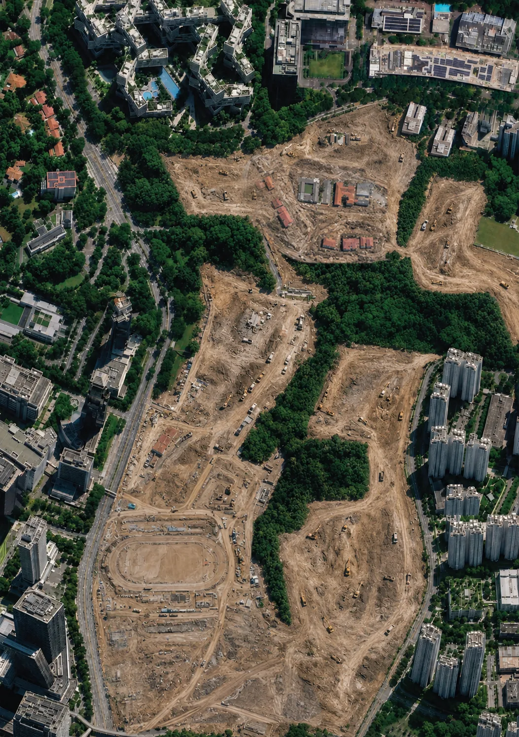
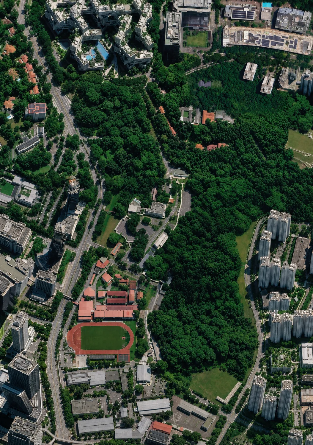 ↔
TodayIf cleared
Right: indicative, residents’ visualisation. Base imagery © Google
↔
TodayIf cleared
Right: indicative, residents’ visualisation. Base imagery © Google
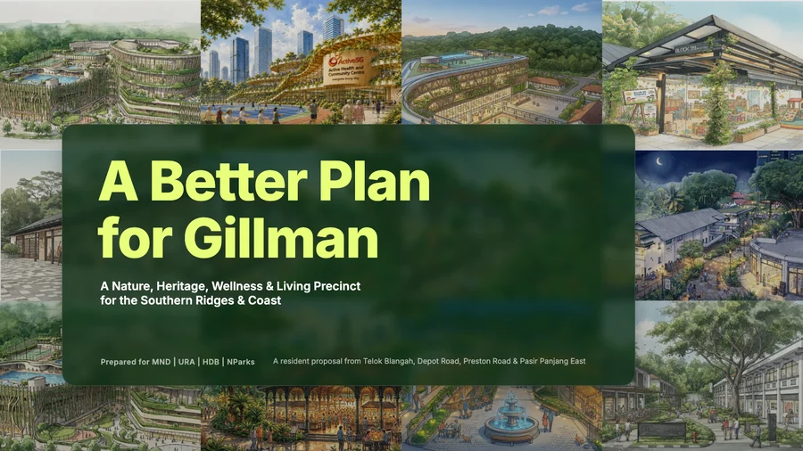 The proposal
A Better Plan for Gillman
Up to 2,400 homes on 538,000 m² across two sites, against 340,000 m² in the July plan, with the forest kept. The maps, the amenities, the alternative sites and what the agencies said to each of it.
The proposal
A Better Plan for Gillman
Up to 2,400 homes on 538,000 m² across two sites, against 340,000 m² in the July plan, with the forest kept. The maps, the amenities, the alternative sites and what the agencies said to each of it.
 Walk, Sun 20 Sep
Hike Gillman Forest and Earth Trail
A free morning walk from Gillman Barracks, 8am to 11am, led by a resident. Limited to 20 people. Register ahead.
Walk, Sun 20 Sep
Hike Gillman Forest and Earth Trail
A free morning walk from Gillman Barracks, 8am to 11am, led by a resident. Limited to 20 people. Register ahead.
 Concert, Sat 3 Oct
Everything Nature, with a Save Gillman Forest booth
Bukit Batok Chinese Orchestra at SOTA Concert Hall. Lobby activities from 4.15pm, concert at 5pm.
Concert, Sat 3 Oct
Everything Nature, with a Save Gillman Forest booth
Bukit Batok Chinese Orchestra at SOTA Concert Hall. Lobby activities from 4.15pm, concert at 5pm.
 Read
What is the whole housing pipeline being sized for?
The Government calls 6.9 million a planning parameter, not a target. No figures have been published for the far larger pipeline Gillman sits inside.
Read
What is the whole housing pipeline being sized for?
The Government calls 6.9 million a planning parameter, not a target. No figures have been published for the far larger pipeline Gillman sits inside.
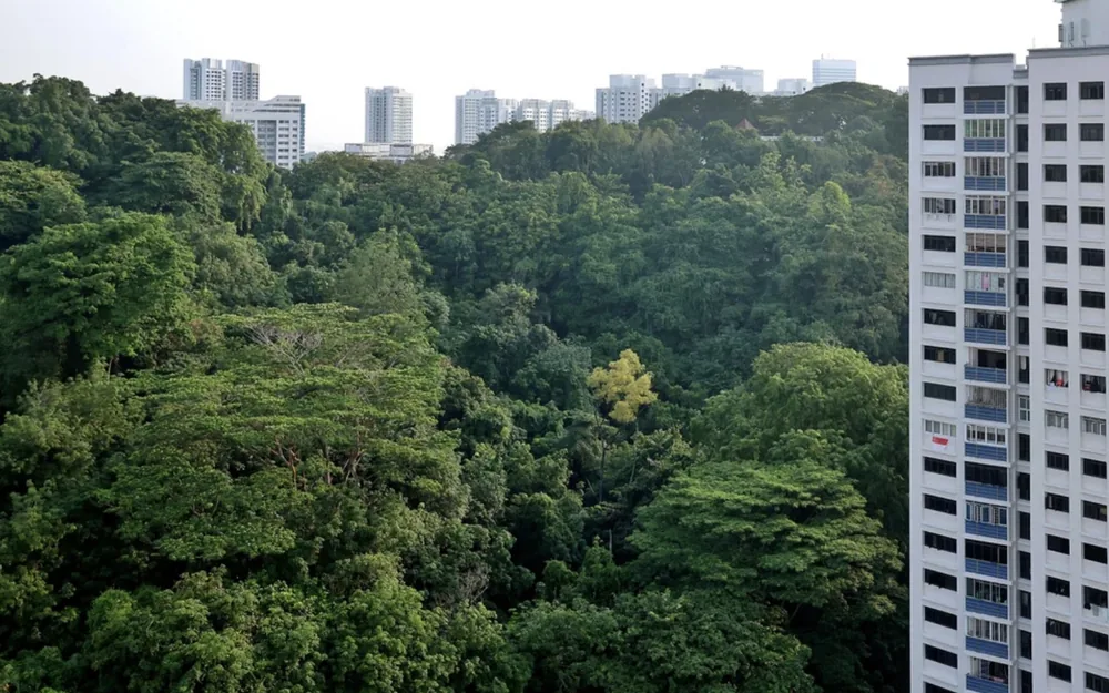 Read
Don’t mourn Gillman Forest? First ask if we need to lose it
Melissa Low of NUS in the Business Times, asking how many of the homes this particular forest is actually required to supply.
Read
Don’t mourn Gillman Forest? First ask if we need to lose it
Melissa Low of NUS in the Business Times, asking how many of the homes this particular forest is actually required to supply.
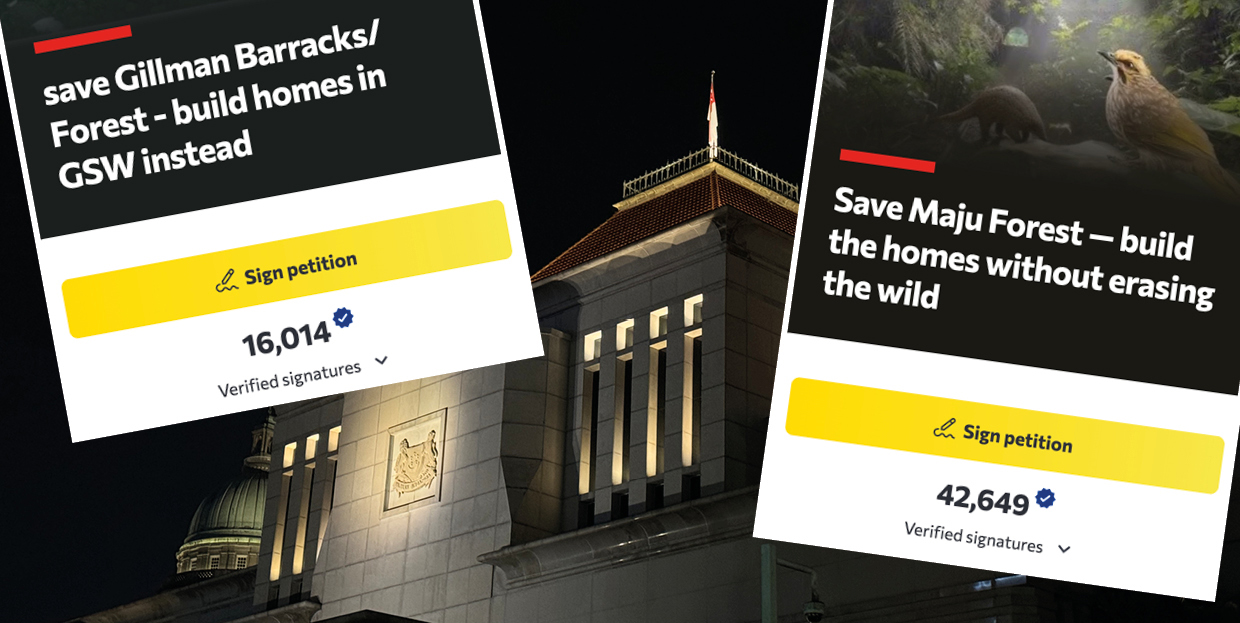 Read
Beyond consultation: what Gillman revealed about how we plan
Melissa Low of NUS on why residents were left unanswered, and what a planning system that listens would do differently.
Read
Beyond consultation: what Gillman revealed about how we plan
Melissa Low of NUS on why residents were left unanswered, and what a planning system that listens would do differently.
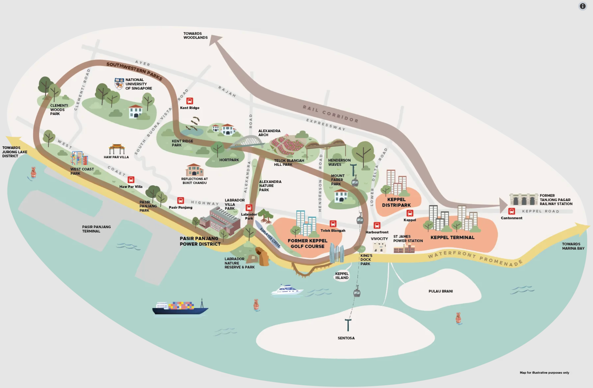 Read
A former HDB planner on how these plans get made
Yong Feng masterplanned the Keppel Club site from inside HDB. On zoning, housing targets and why the trees still went.
Read
A former HDB planner on how these plans get made
Yong Feng masterplanned the Keppel Club site from inside HDB. On zoning, housing targets and why the trees still went.
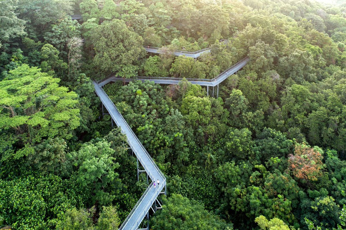

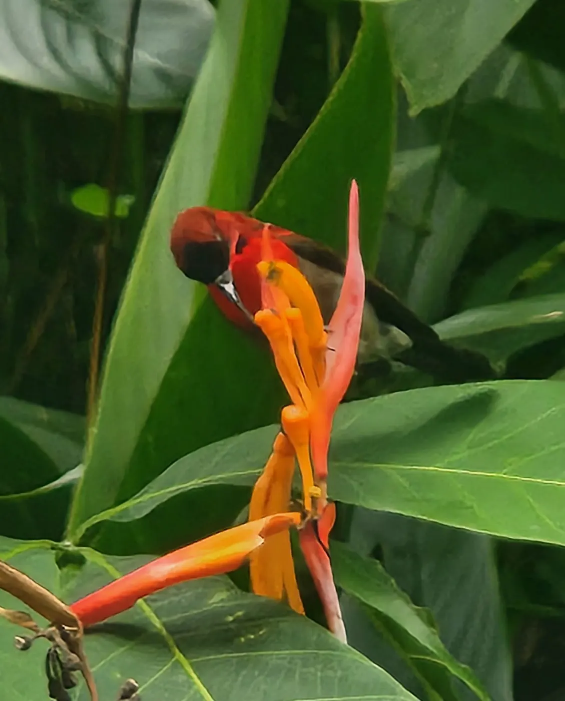
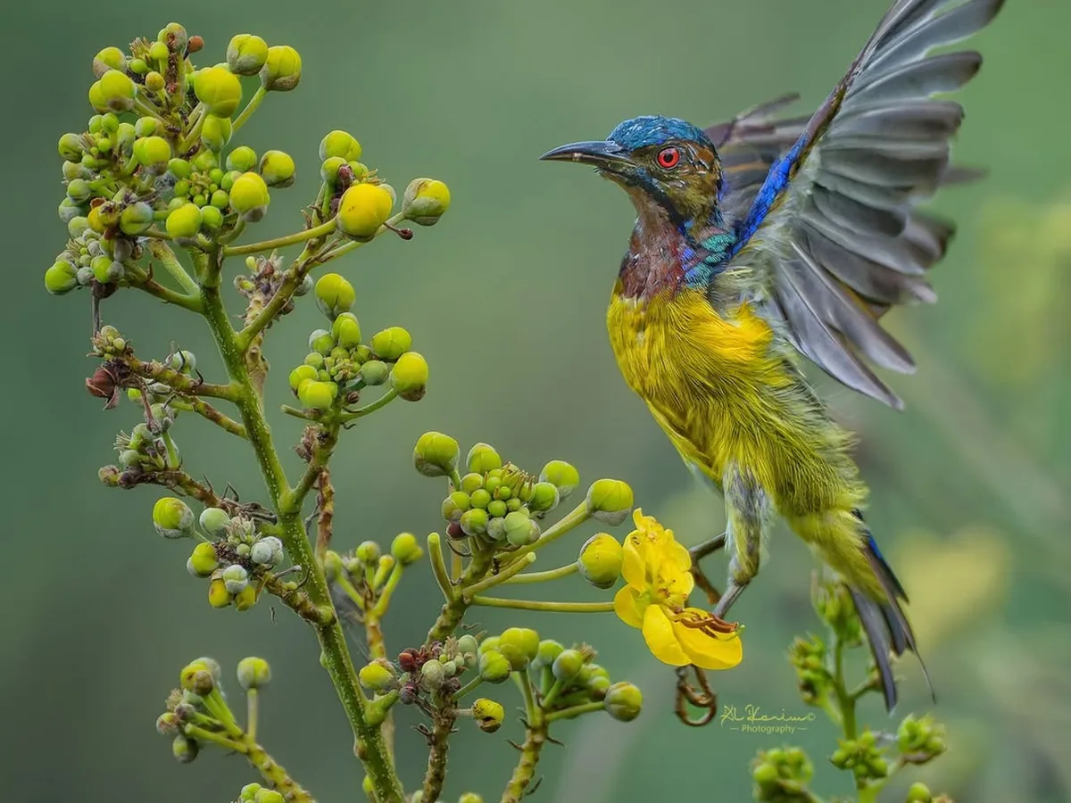
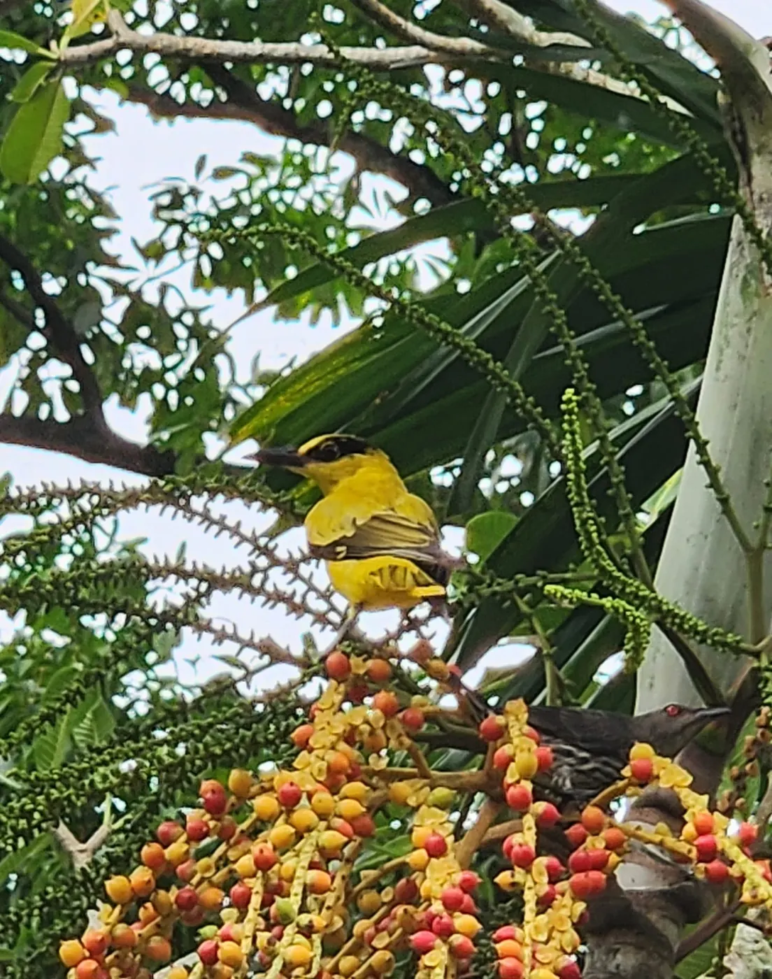

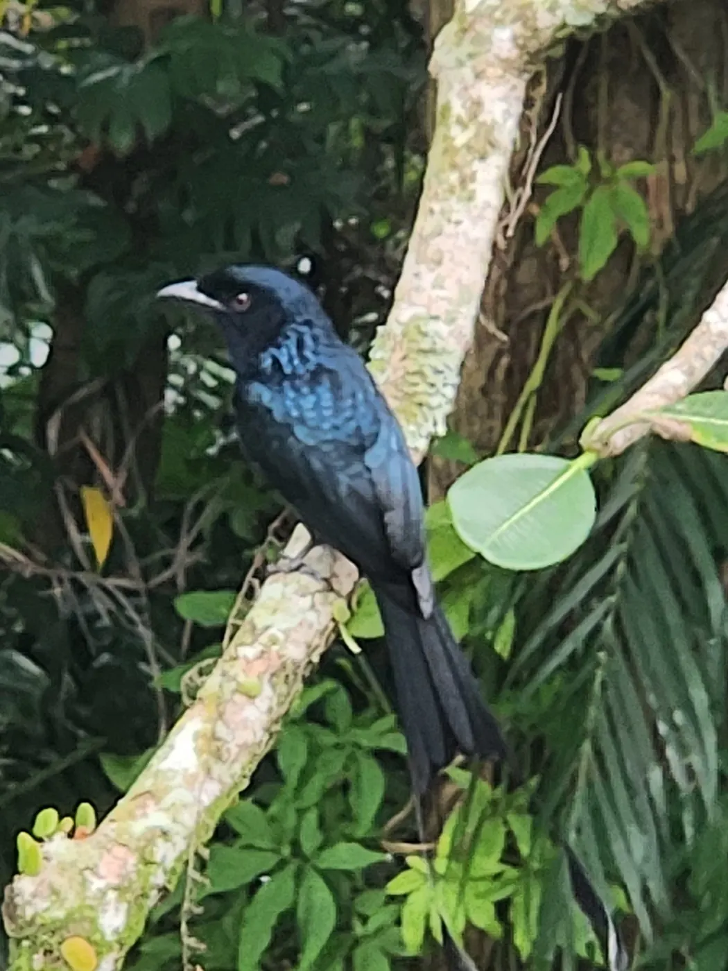
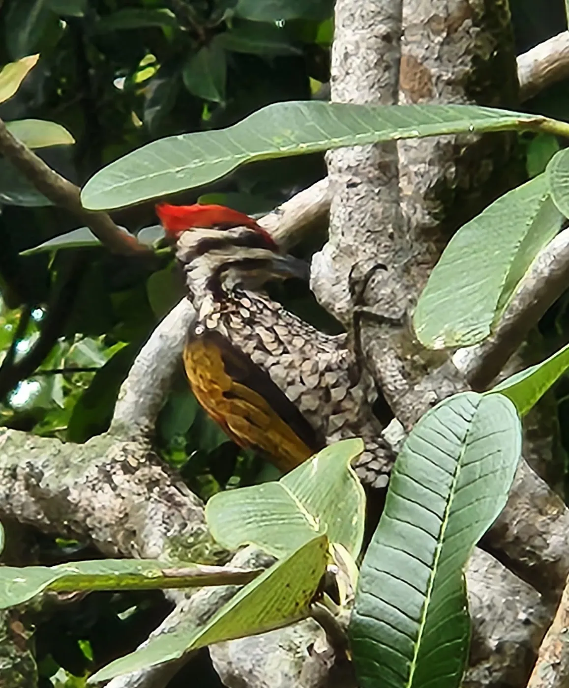
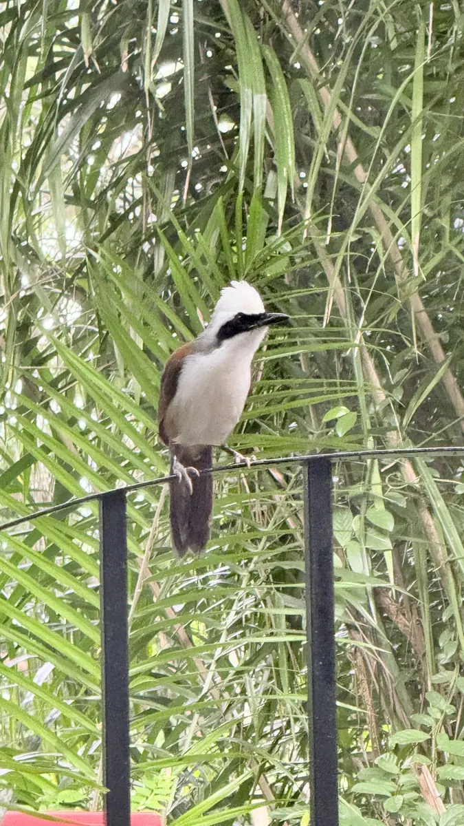

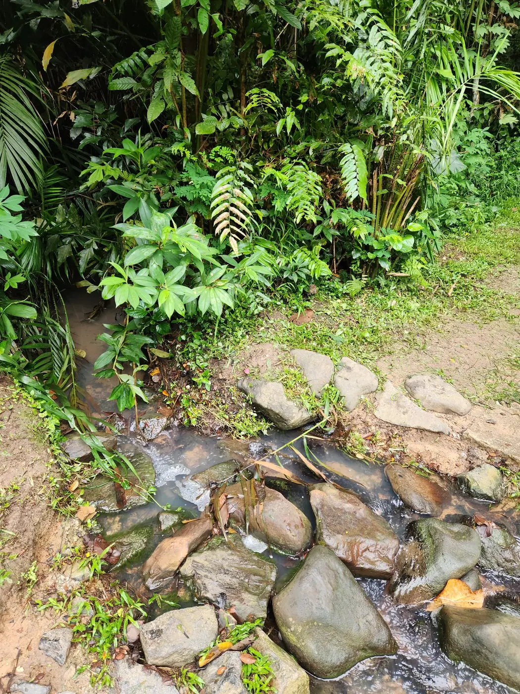
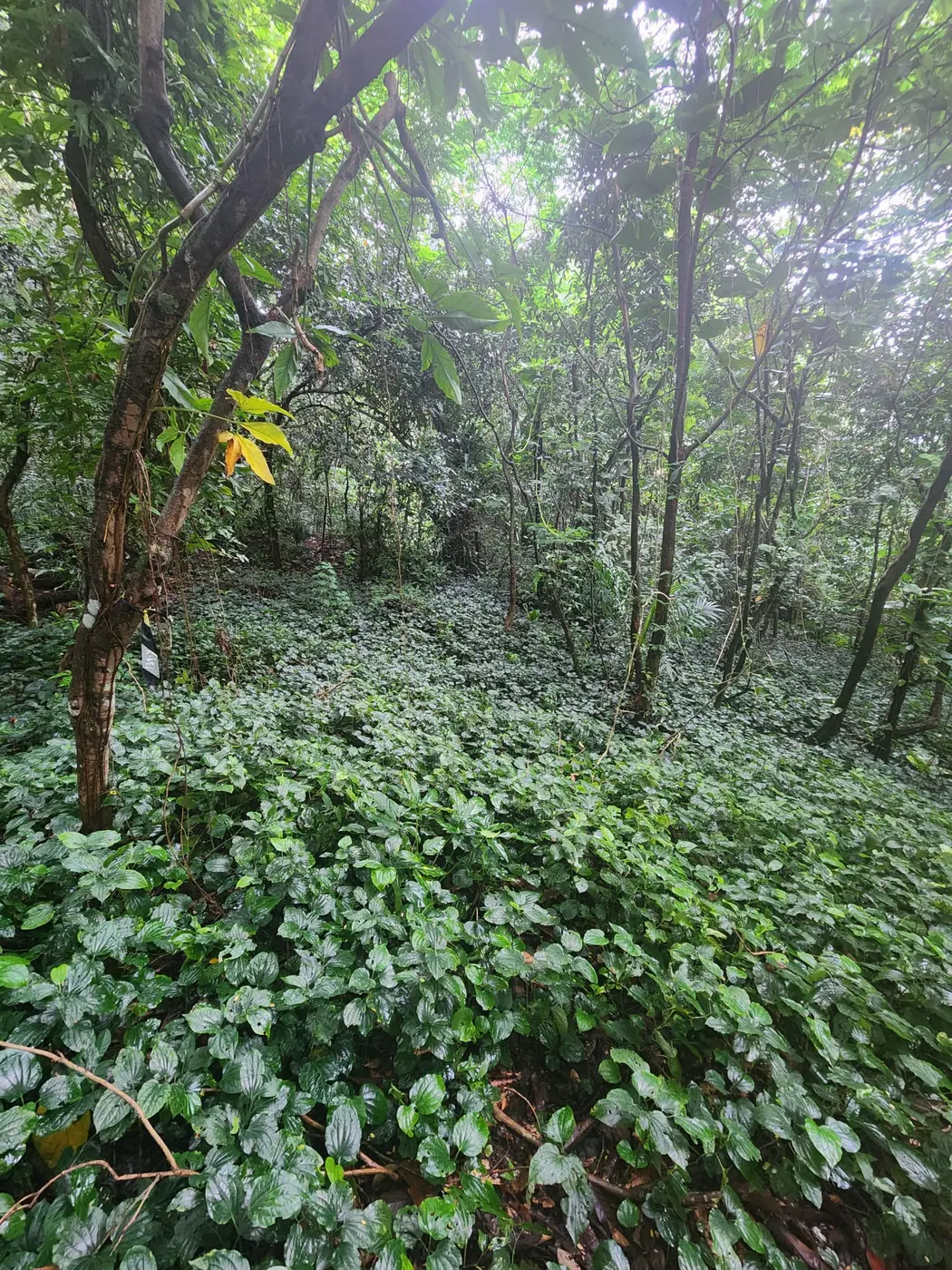
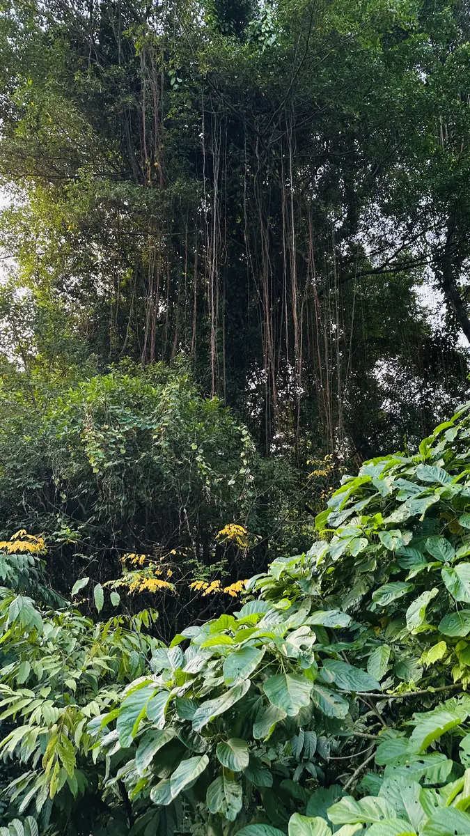
 The full record of the sessionPDF
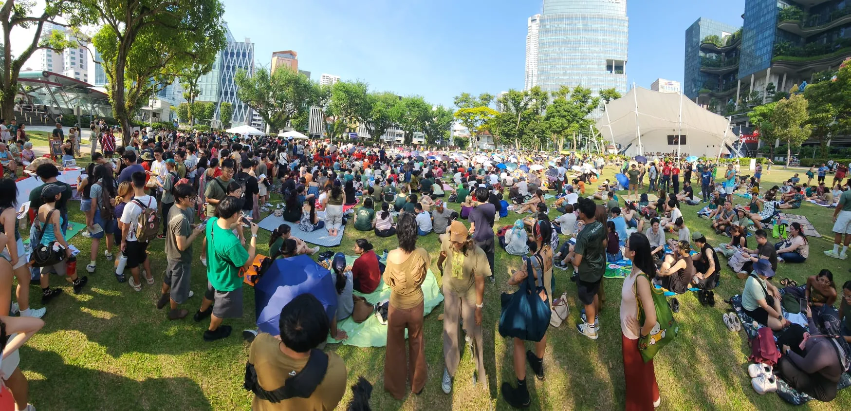
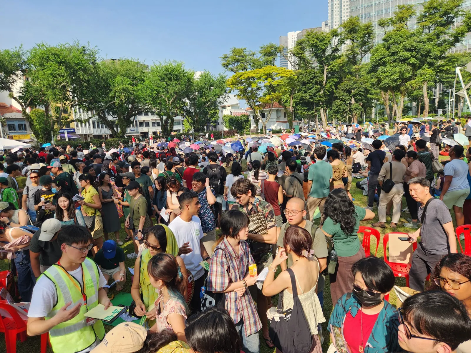
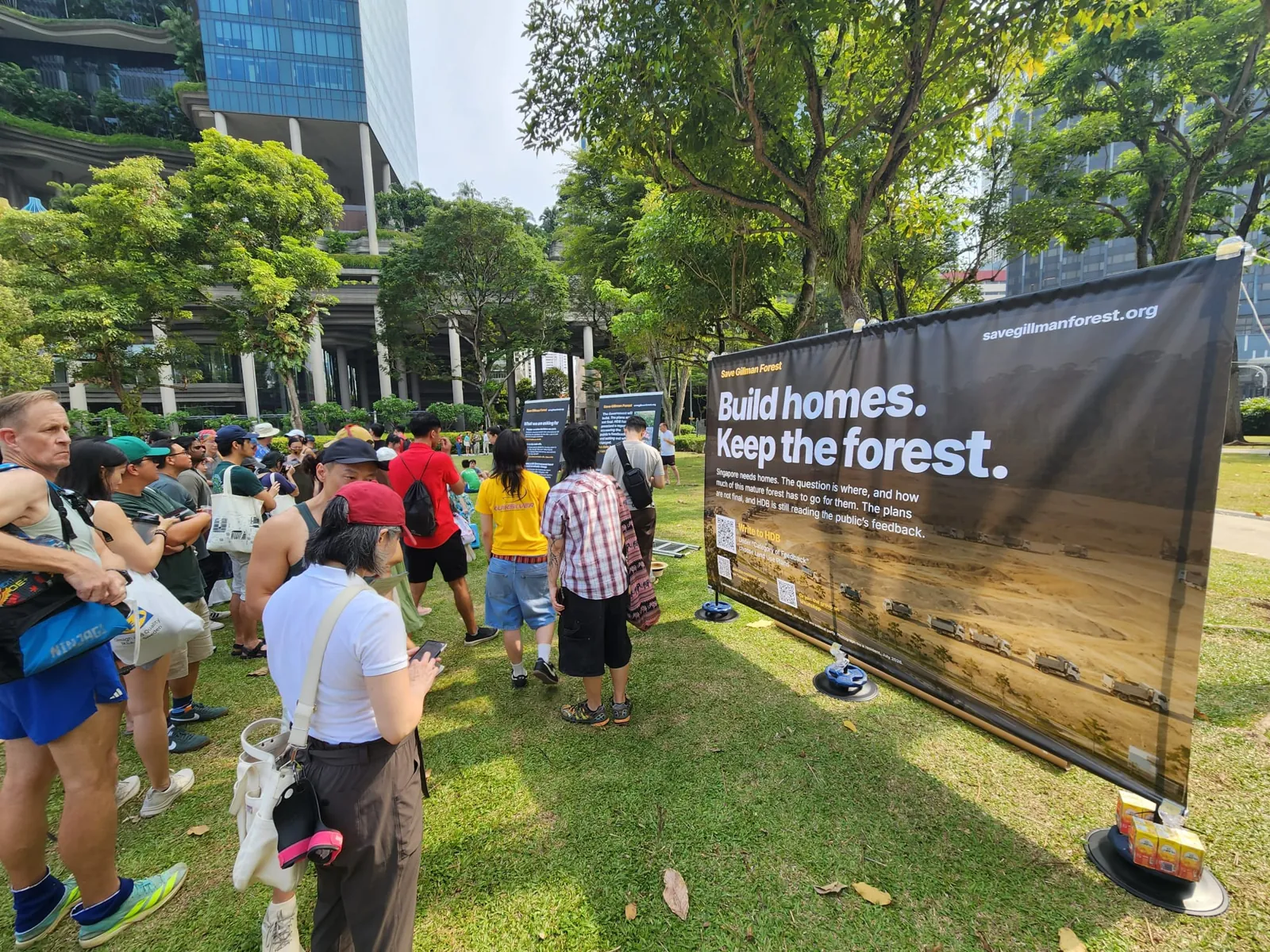
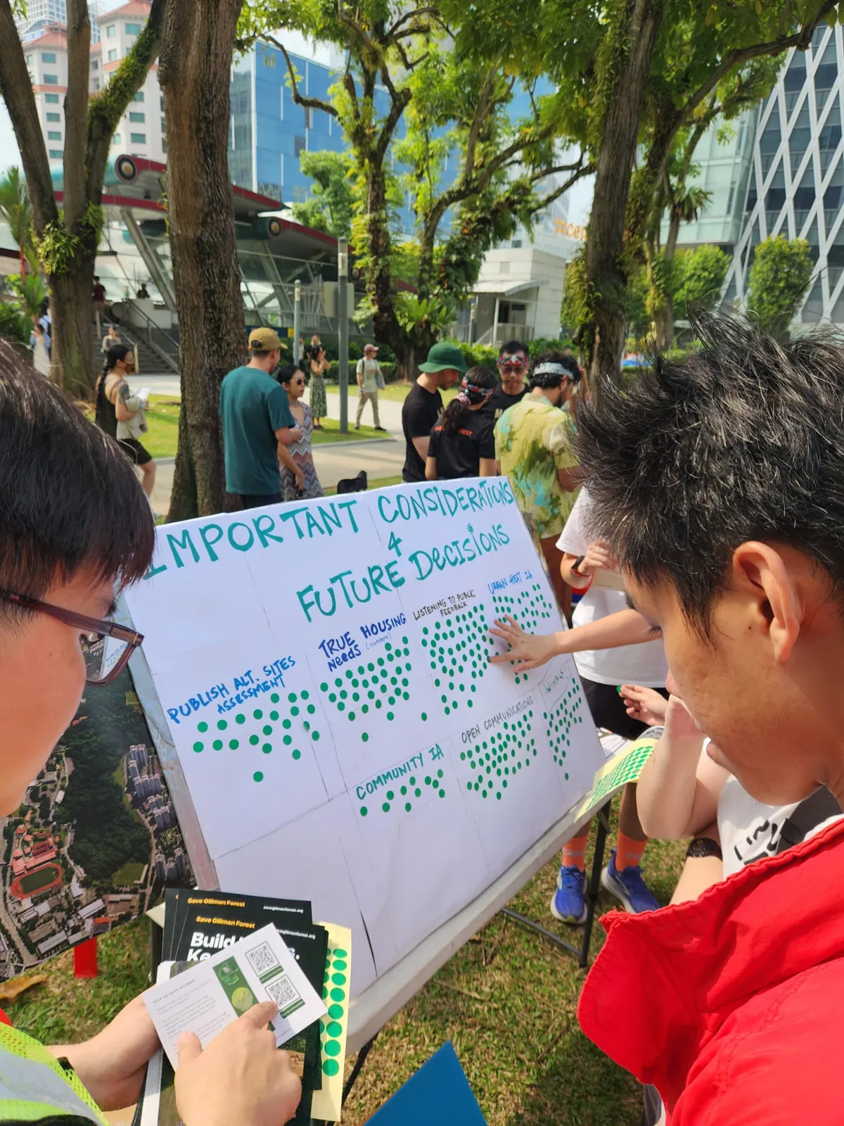
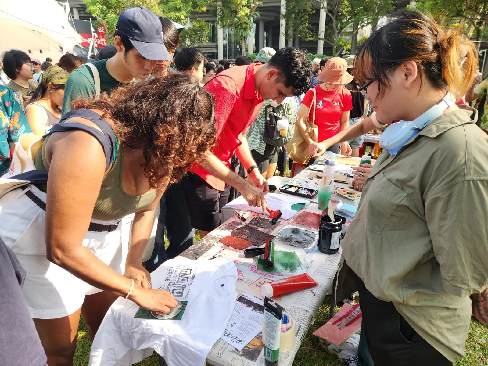

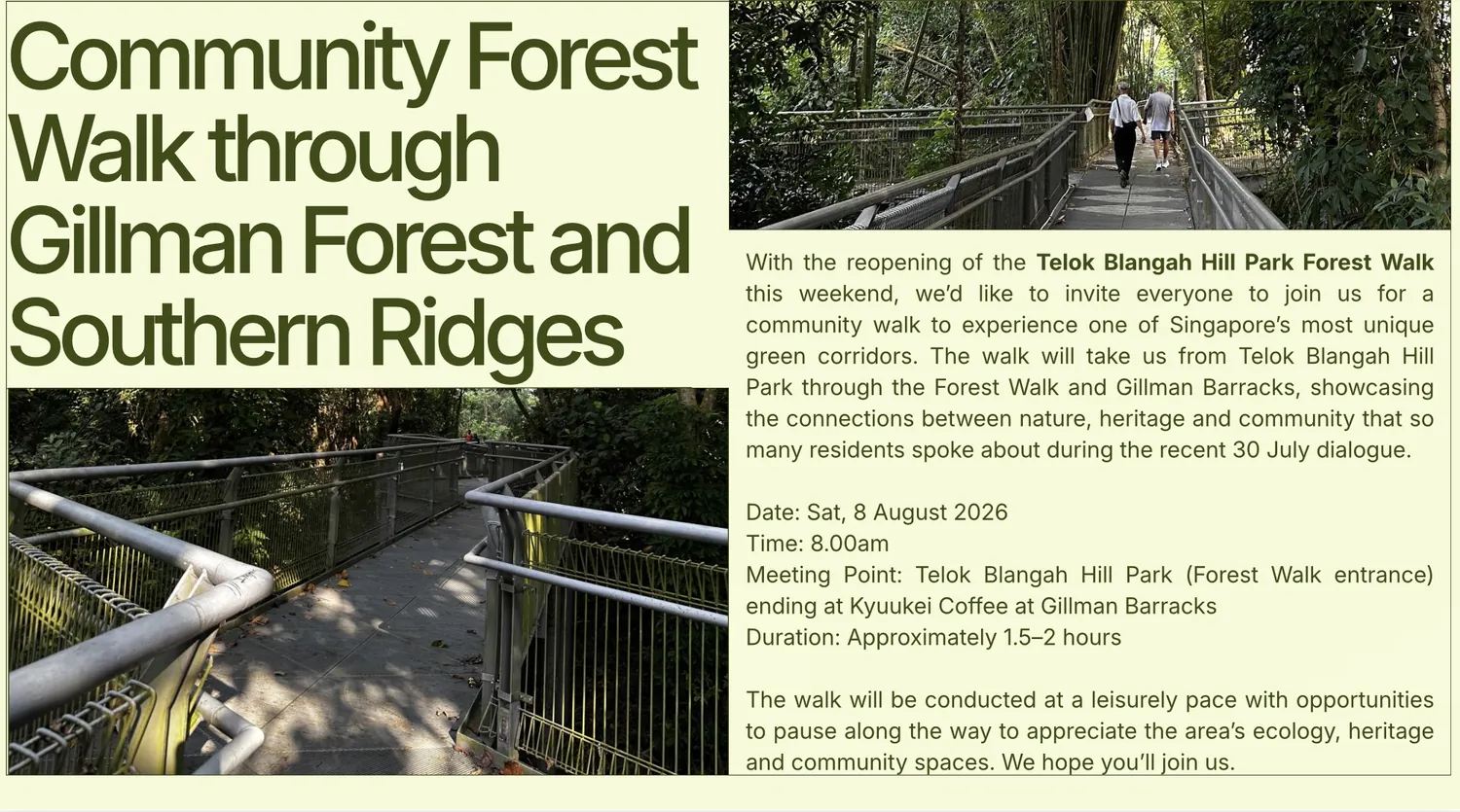
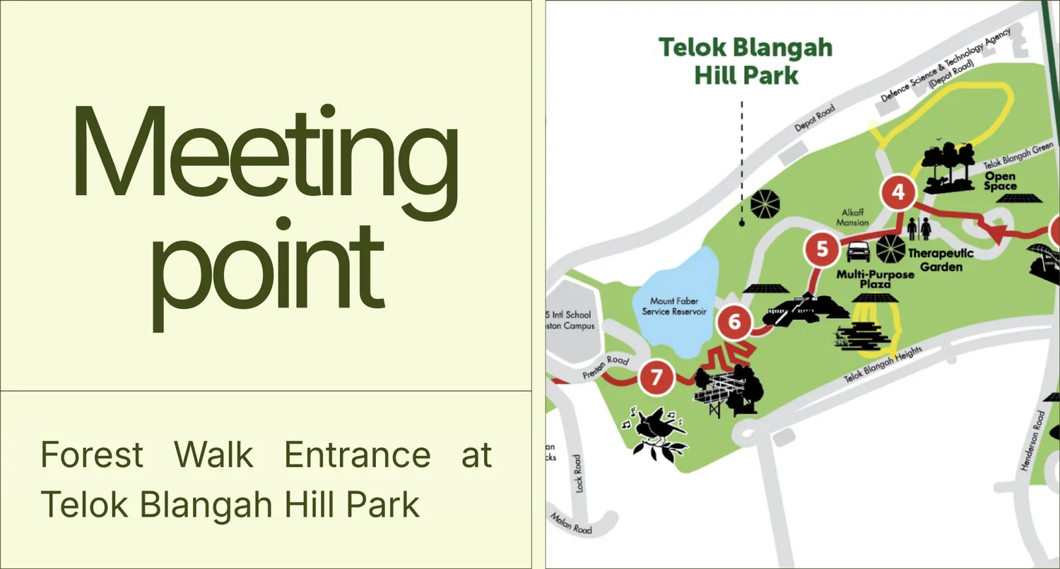
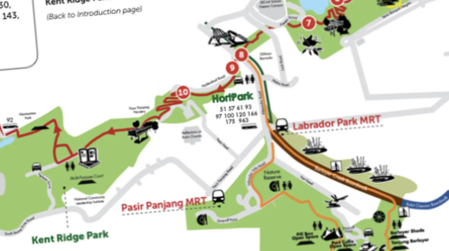
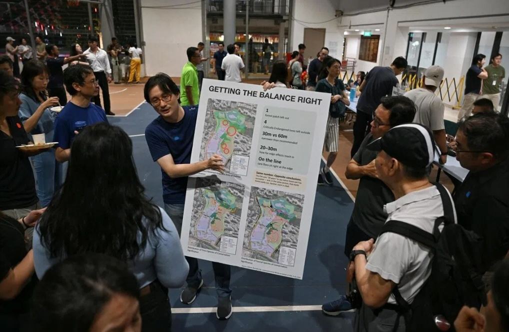
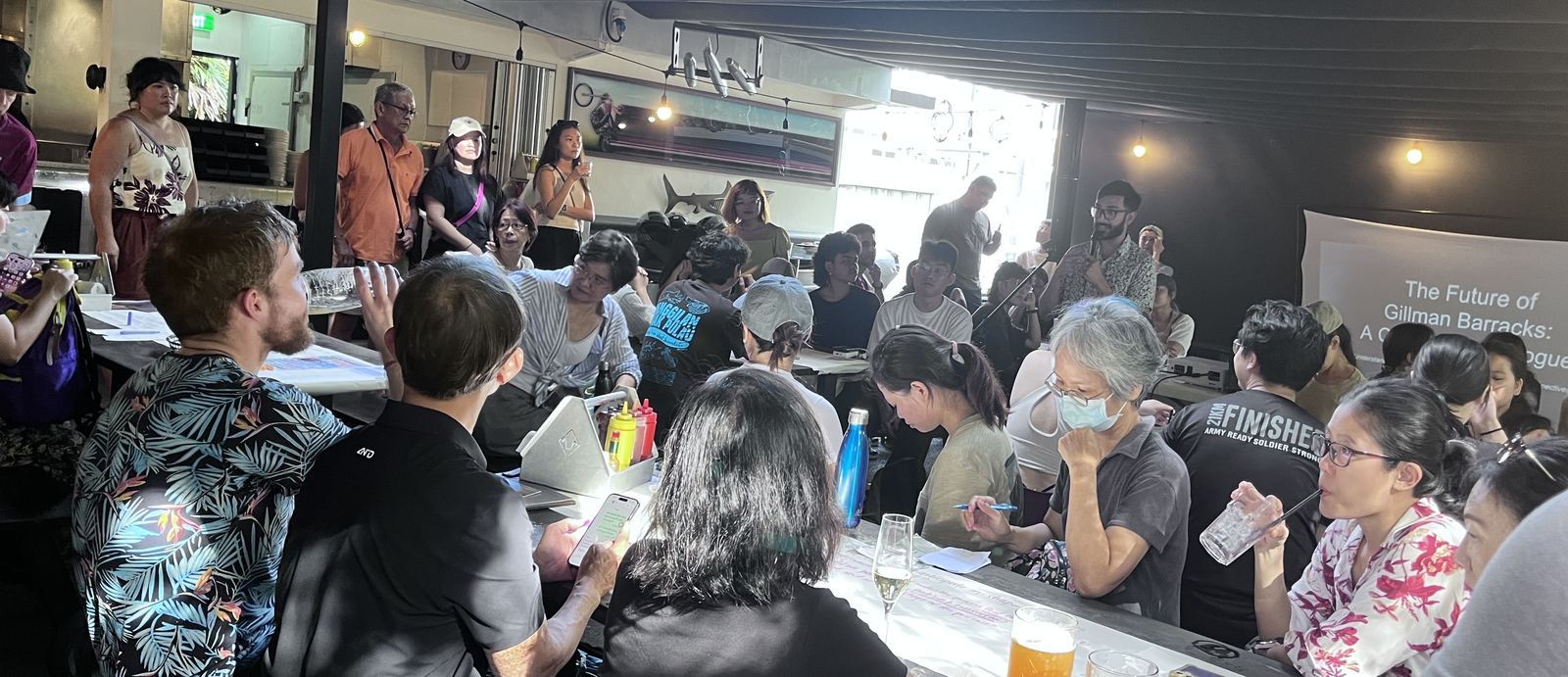
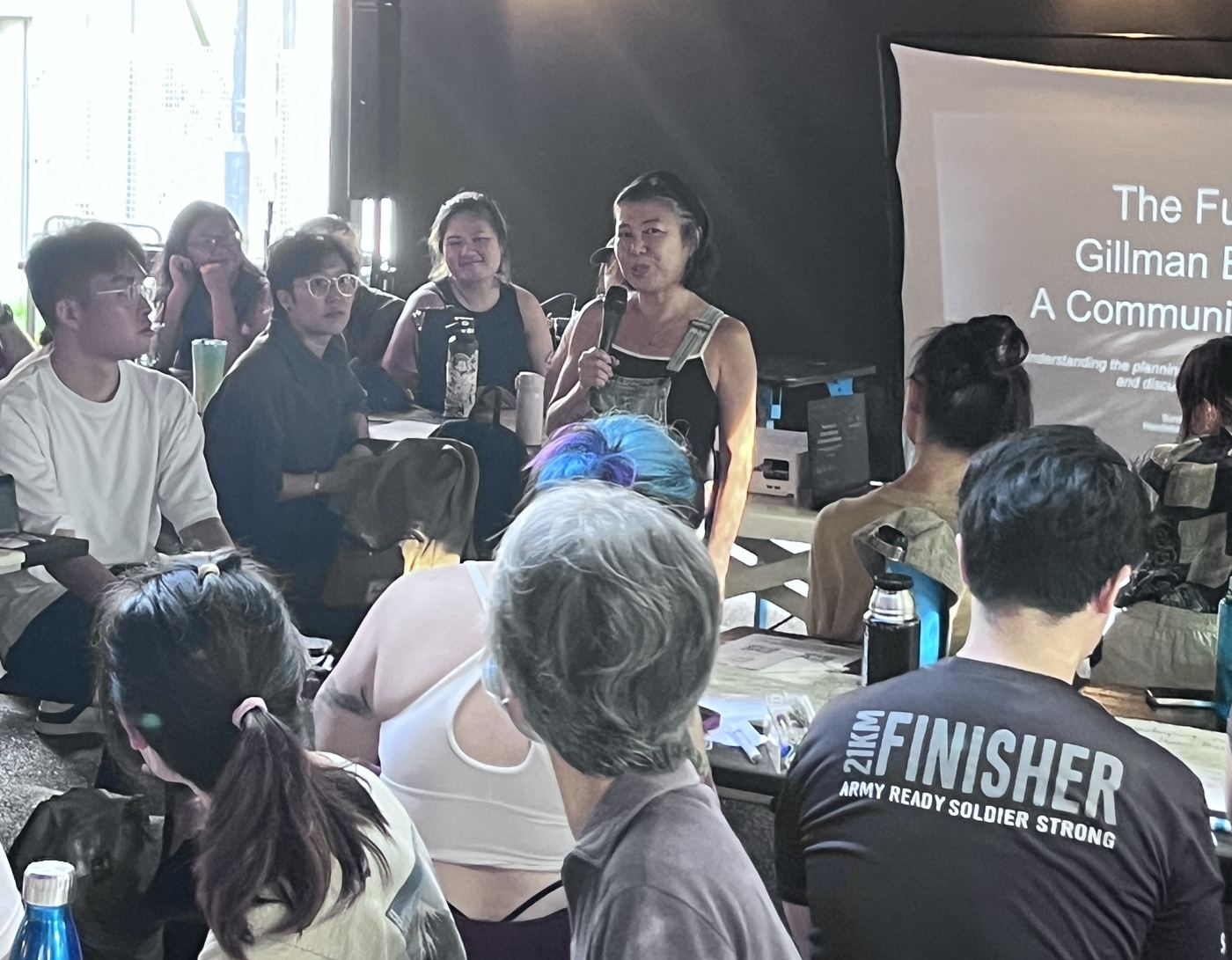




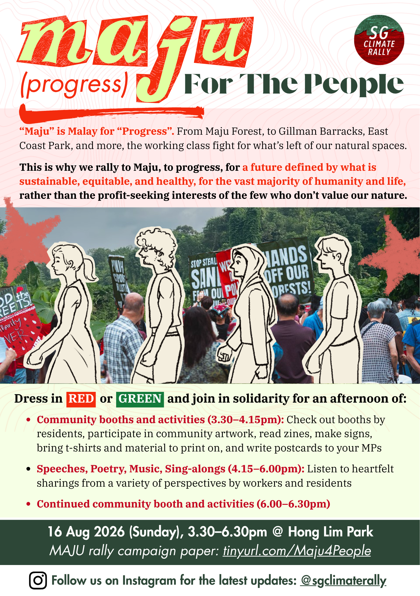



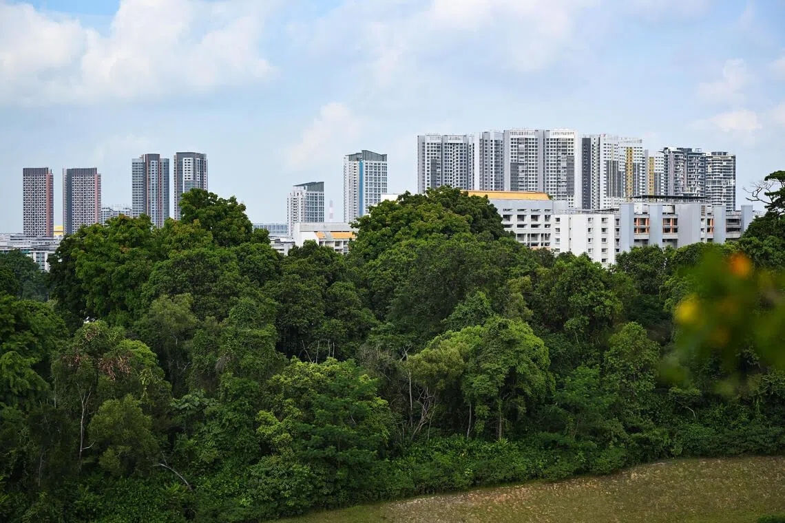

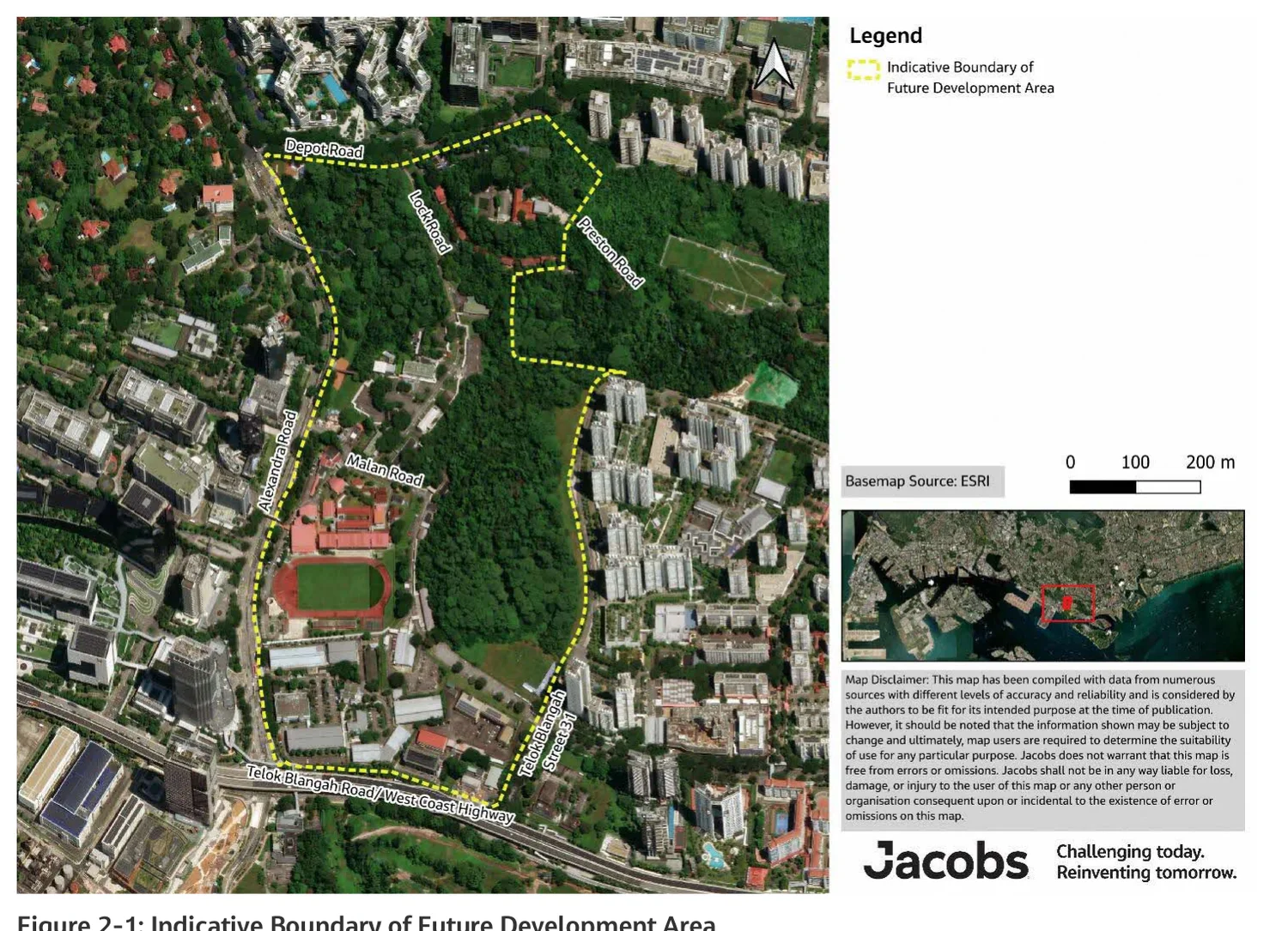
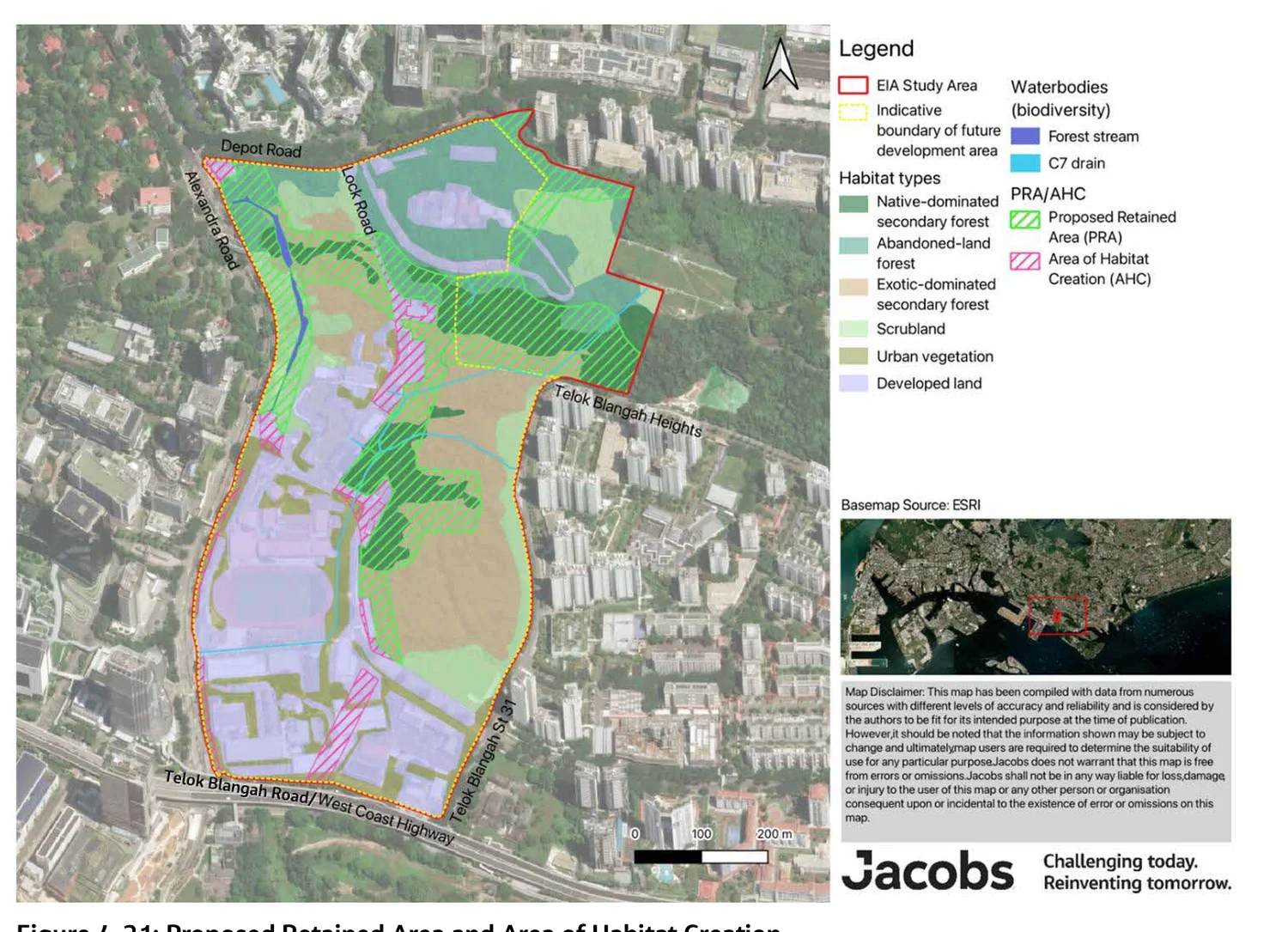
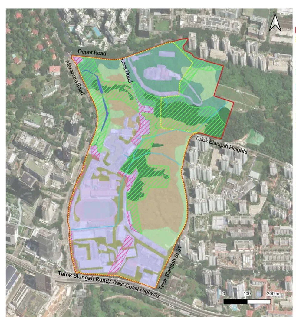
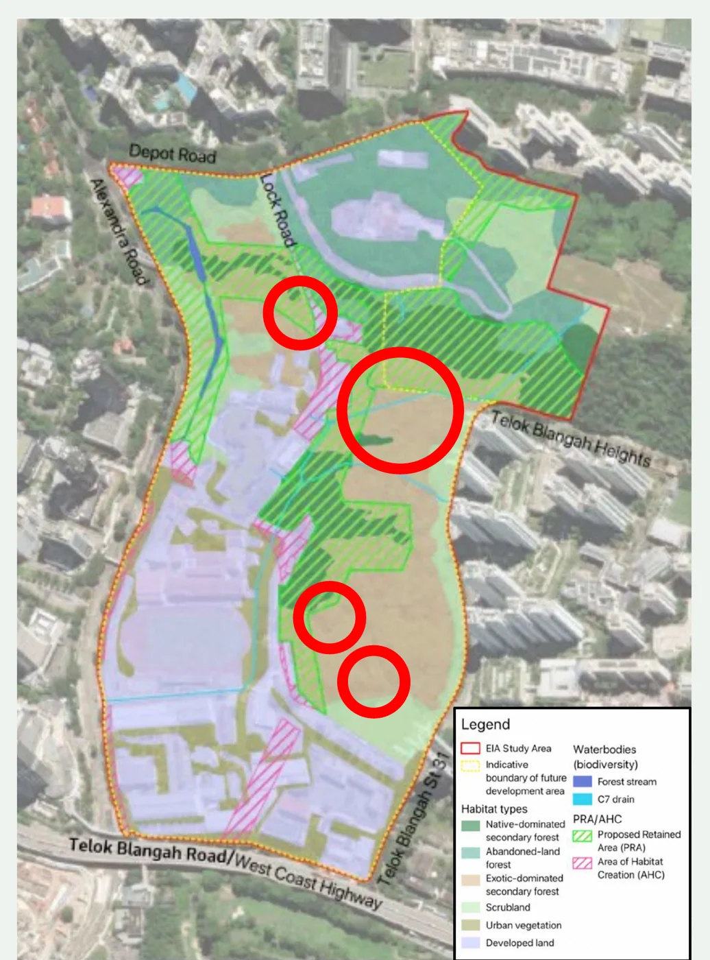
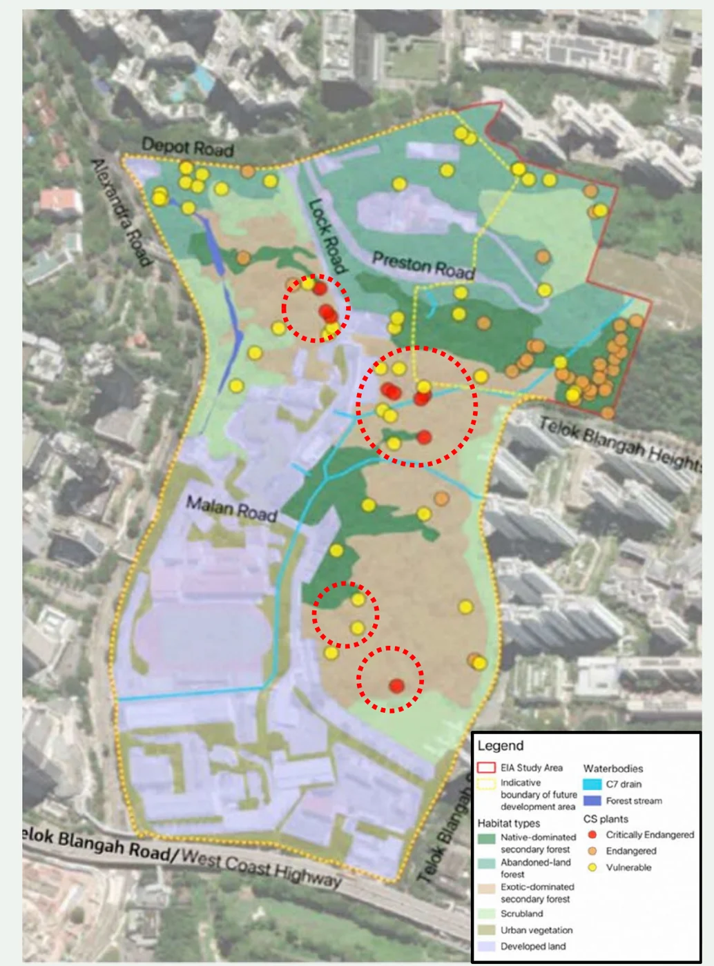
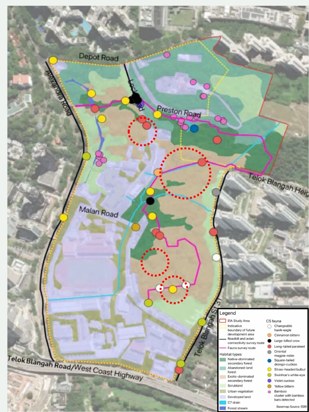
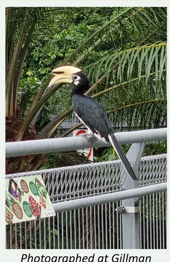

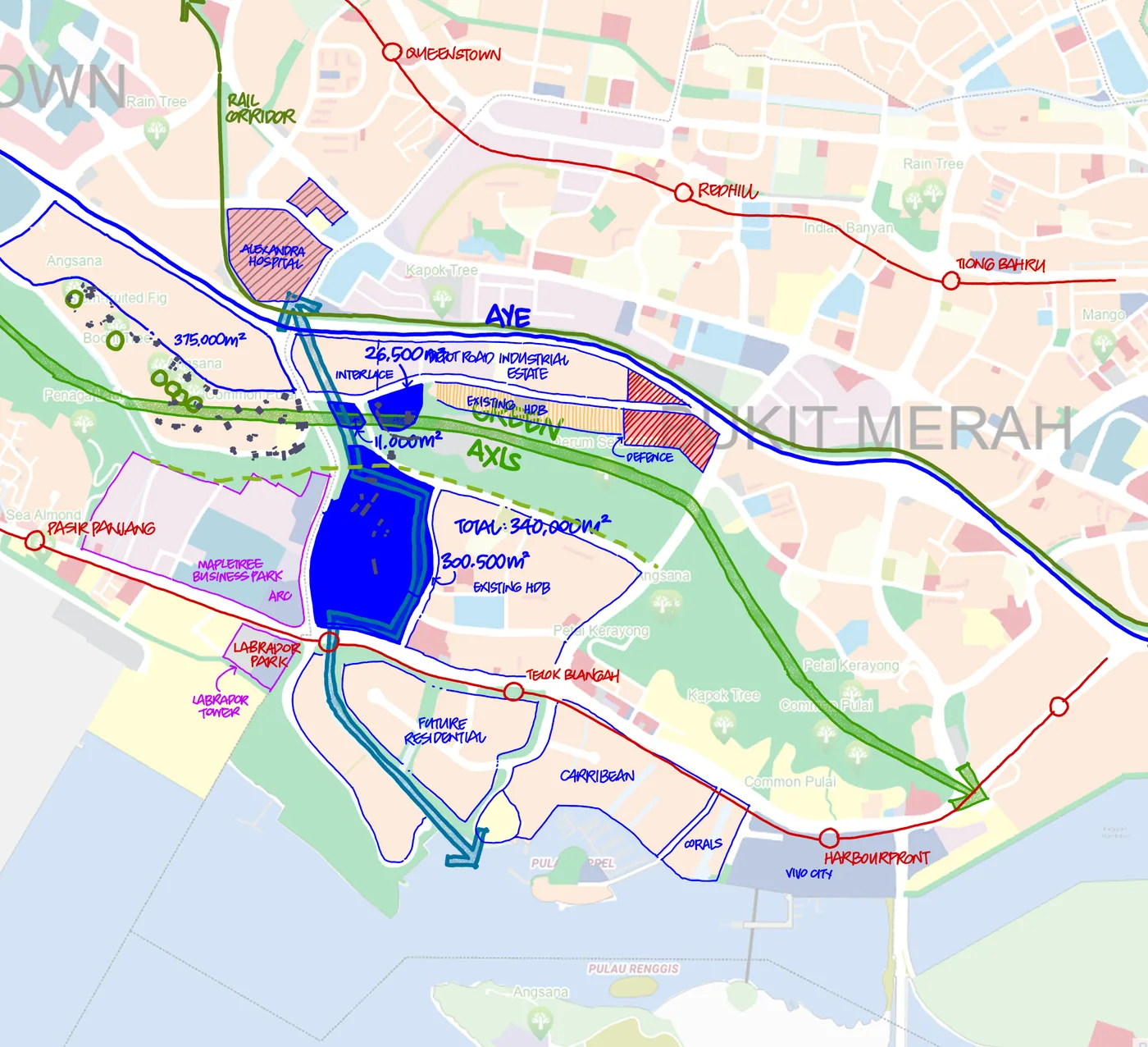
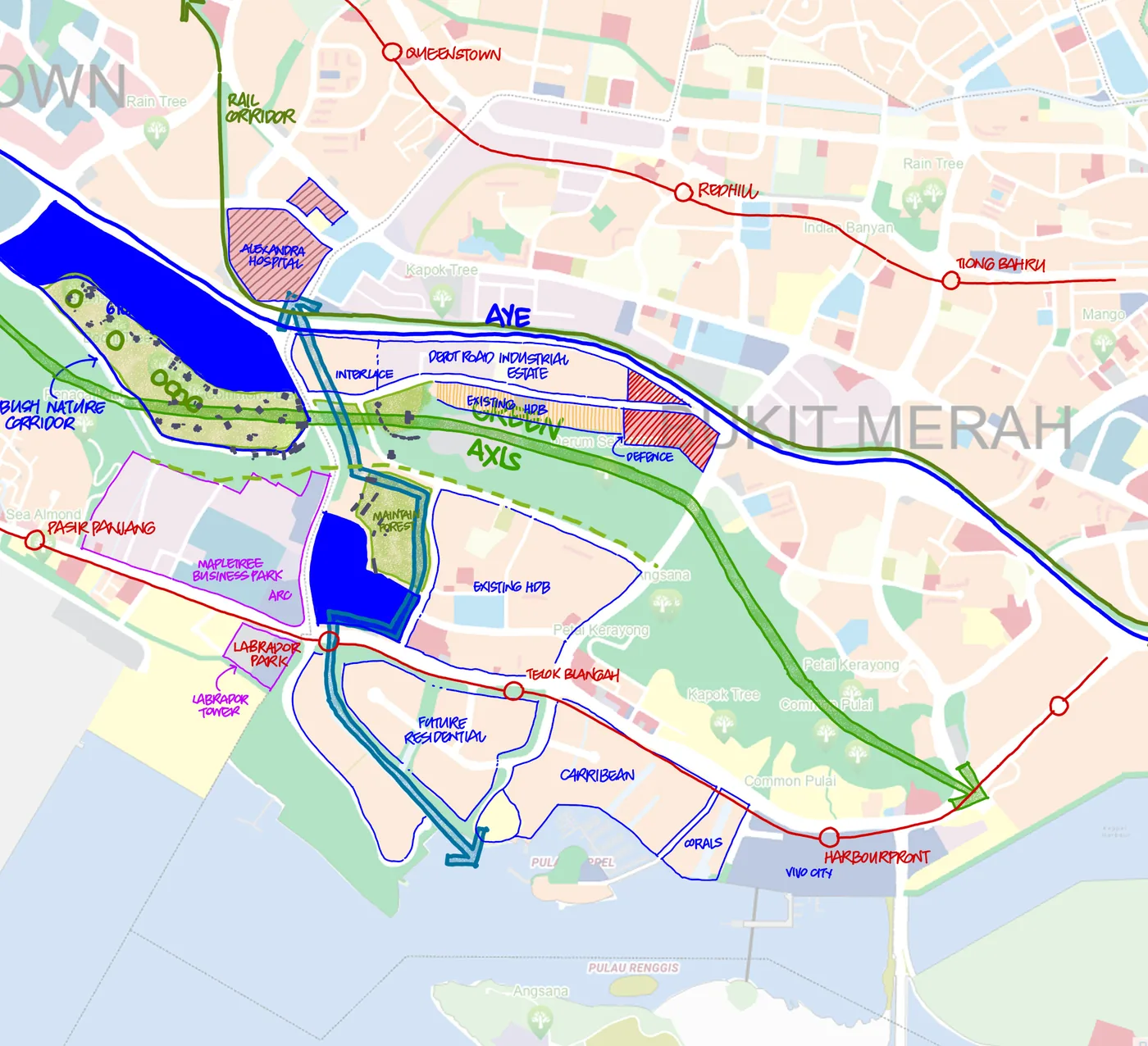
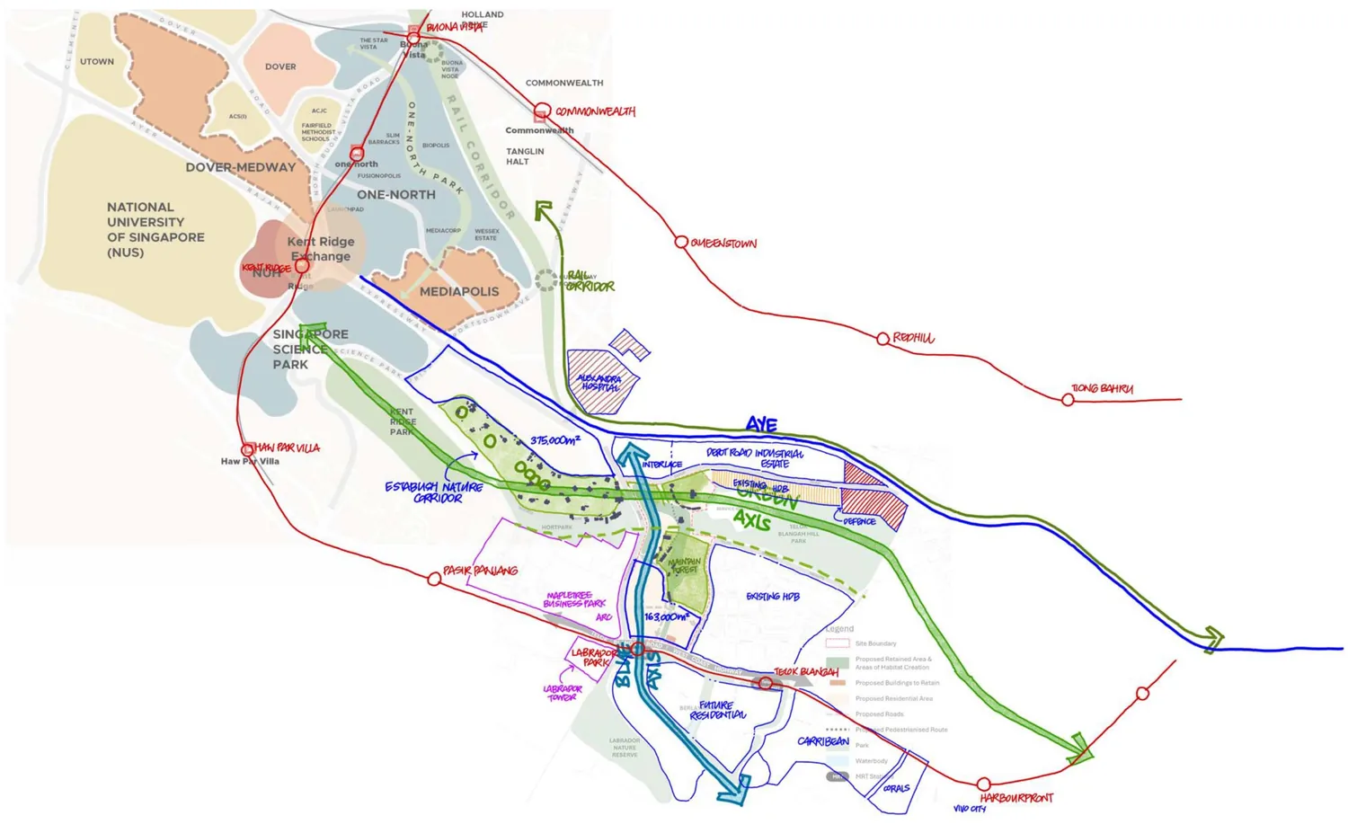
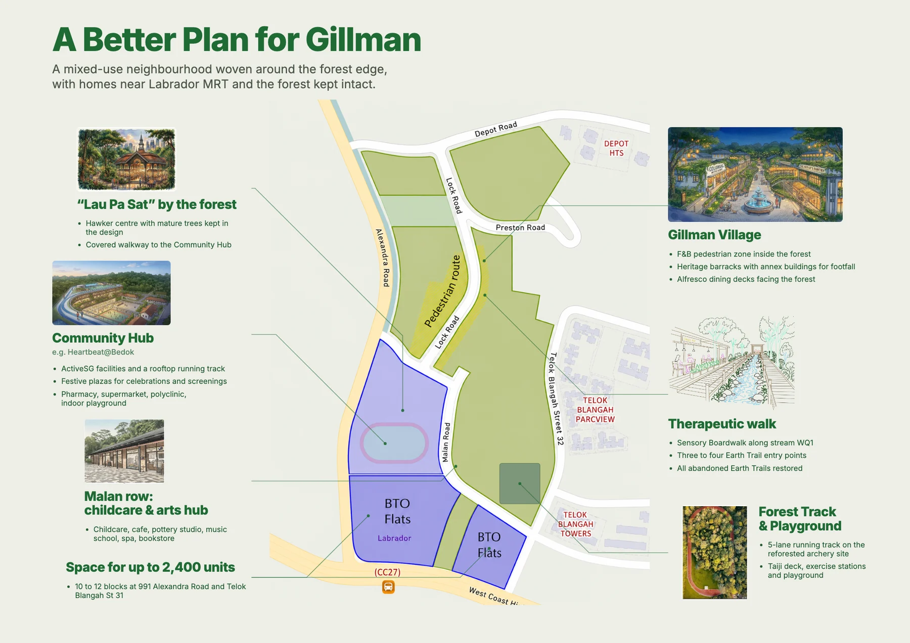
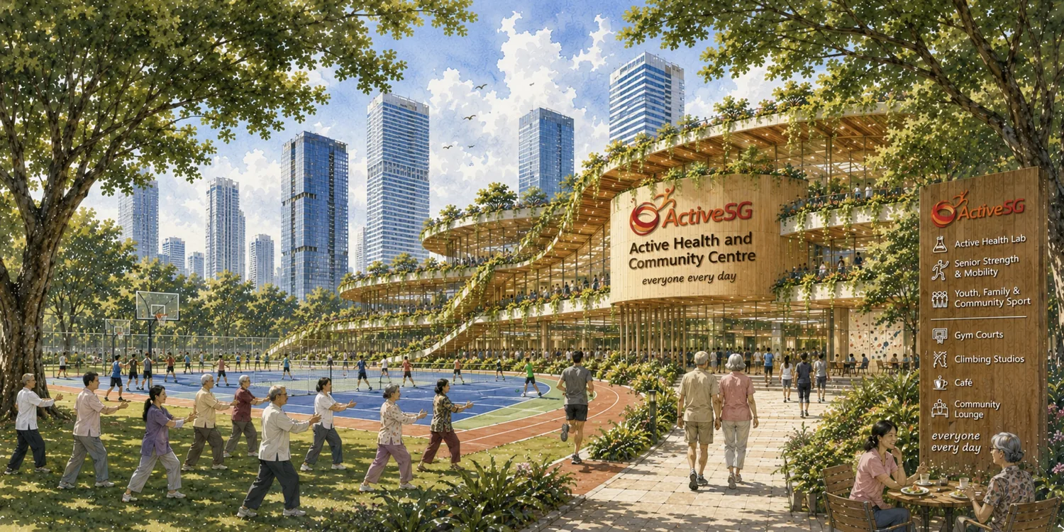
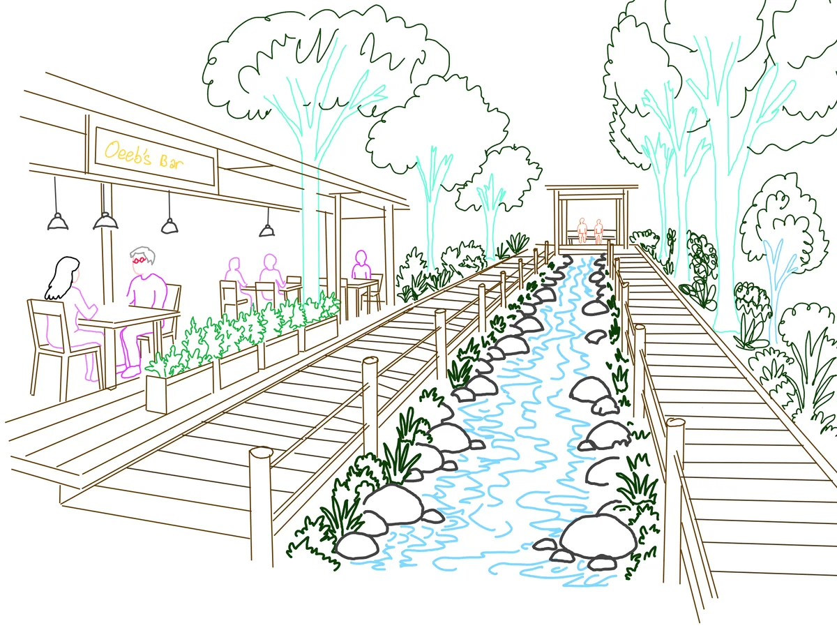
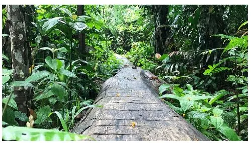
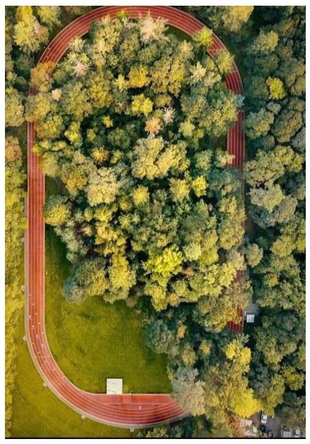
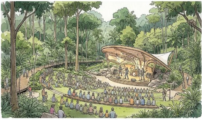
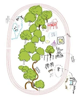
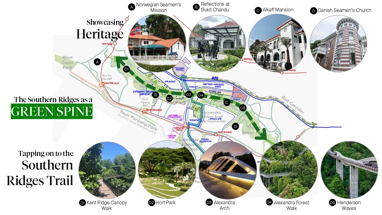
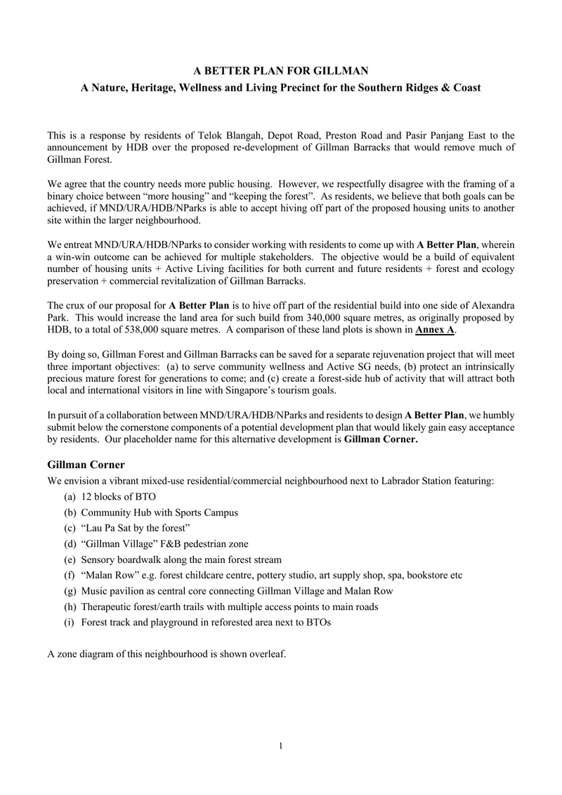 Read the written submission, with the zone-by-zone detail and Annexes A, B and CPDF
 Scan to open it on your phone